1973
2017


| Home | Trip Report 2017 | Contact |
11-Jul-2017
This section examines the changes in Glacier Benito between 1972 and 2017 further up the glacier.
1973 |
2017 |
|
|
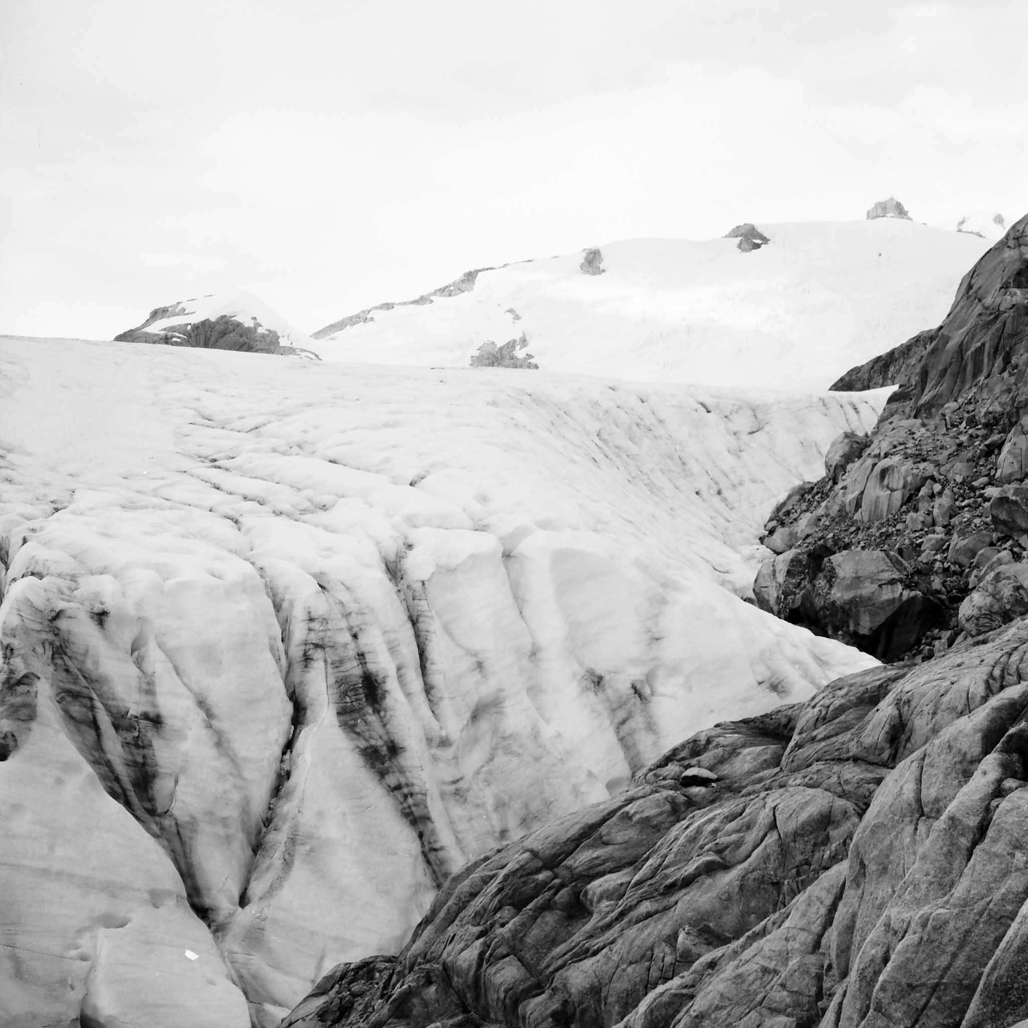
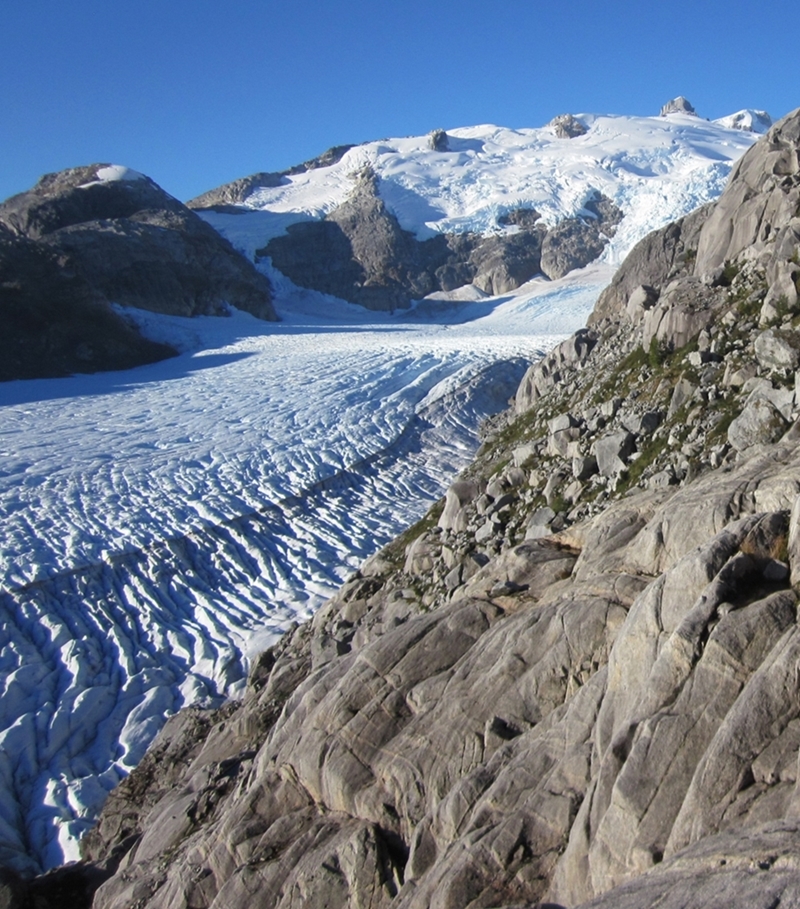
| View of the Accumulation Zone of Glacier Benito from 'Level 1' Upper Cairn on Co Caldenius in February 1973 | Same view in April 2017. |
|
|
| View from 'Level 1' Upper Cairn at the Finger looking down glacier in February 1973 | Same view in April 2017. |
|
|
| View from 'Level 1' Upper Cairn at the Finger looking at Co Caldenius in February 1973 | Same view in April 2017. The surface of the glacier is now over 140 meters lower. |
|
|
| View towards the North-East from 'Level 1' Lower Cairn in March 1973 | Same view in April 2017. |
|
|
| View from 'Level 2' Lower Cairn at the Finger looking at 'Dump Ridge' in February 1973 | Same view in April 2017. The surface of the glacier is now over 135 meters lower. |
|
|
| In February 1973 we climbed to the top of the Finger (altitude around 1200 m) and took a panaroma. This is one comparison from that panorama. | Same view in April 2017. |
|
|
| This photo was taken in mid March 1973 at 'Stake 10' looking at the majestic peaks in the accumulation zone of Glacier Benito. | Same view in April 2017 taken by our drone at a similar altitude to Stake 10 in 1973. |
|
|
| Another view of the majestic peaks in the accumulation zone of Glacier Benito from 'Stake 10'. | Same view in April 2017 taken by our drone at a similar altitude to Stake 10 in 1973. |