16-May-2017
Glacier Benito Revisited 2017 Journal
Prologue - 1972 to 2011
A dream turns into an obsession. Finally an obsession is resolved. How did it happen?
 |
 |
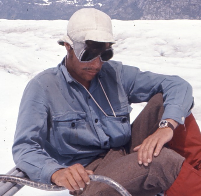
| Martin 1972 |
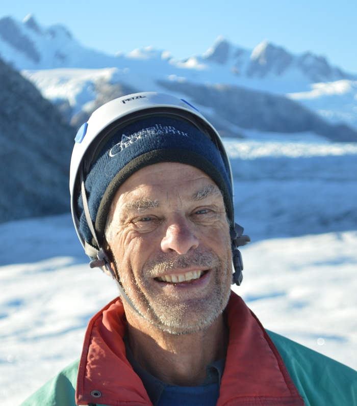
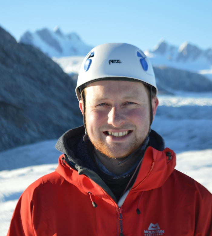
Martin 2017 |
In 1971, Martin was lucky enough to be selected as a member of the 1972/73 British Joint Services Expedition to Chilean Patagonia led by Crispin Agnew. His tasks were to undertake the glacier and weather studies of the expedition. The expedition´s base camp was in Kelly Inlet (Abra Kelly). Professor Otto Nordenskjold with Hugo Pallin and others had made Kelly Inlet their base in their 1921/22 expedition.
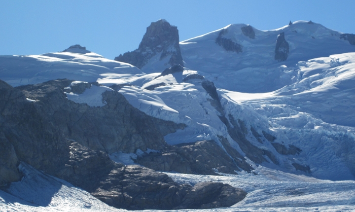
Glacier Benito appeared to be the best glacier to study in the area. It had its own basin, was of a significant size and was accessible from Kelly Inlet. So over the course of four months, ablation was measured, stake movement was monitored, snow line observed and many black and white panoramas taken with a Rollicord camera.
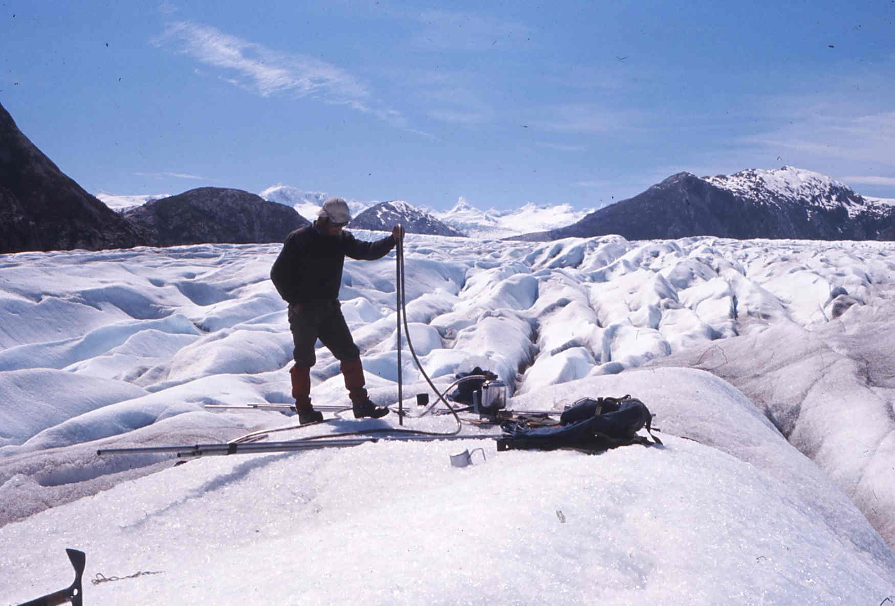 |
| Drilling Holes for Stakes - Glacier Benito Nov 1972 |
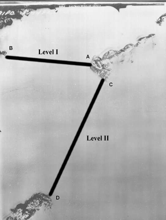
One other important task was undertaken - to measure the surface elevation across the glacier with a surveyor's instrument called a 'Level' near the end of season snow line, 15 kilometres (km) up glacier from its terminus or 'snout'. Total distance measured in February 1972 was 6.5 km in two hops. These two surveyed profiles were called the 'Levels' after the instrument that was used for the task.
 |
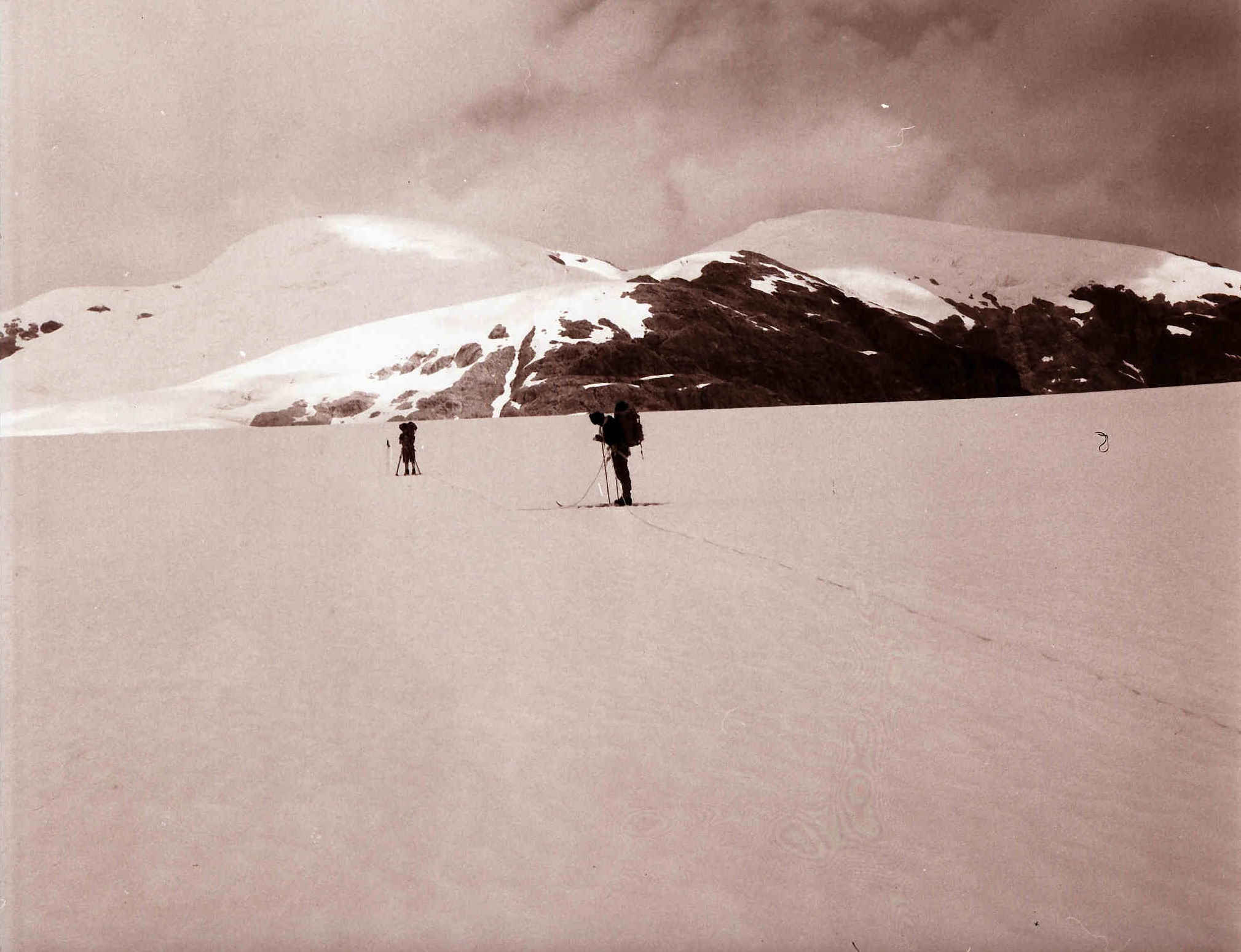 |
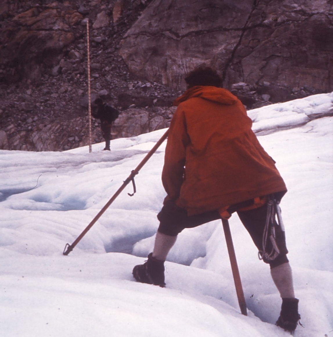
| Levelling on Glacier Benito Feb 1973 |
Measuring Level II on snow - Glacier Benito Feb 1973 |
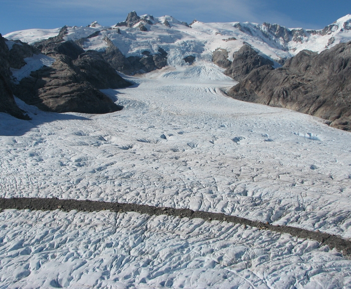
Subsequent to the expedition, starting in 1974, aerial photographic surveys were undertaken, then from about 2000 satellite photographs and radar images with ever increasing resolution became available. But, due to the remoteness of this region, the accuracy of the contour lines on the map was 'questionable' until recently because of the absence of local ground control.
If an end of each level could be fixed into the world grid system and the accuracy of the measured altitude of the levels validated then we would be able to measure how much the glacier has thinned since 1973 in its middle zone.
In the 1990s, this was a dream for Martin but a walk on Franz Joseph glacier in New Zealand which coincided with an e-mail from Charles Warren of St Andrews University indicated there was a possibility of realising the dream. After discussions with Neil Glasser (Aberysthwyth University), Stephan Harrison (Exeter University) and Vanessa Winchester (Oxford University) together with an investigation visit to Region XI hosted by Graham Hornsey, the dream came close to becoming true.
The 2007 Expedition, with Olaf as guide, undertook important survey work in fixing the lower stake network but access to the Levels was too difficult because of the emergence of additional icefalls as the glacier thins and steepens. An important outcome of this expedition was Vanessa Winchester's paper Post-1850 changes in Glacier Benito, North Patagonian Icefield, Chile.
 |
| Survey Work - Glacier Benito Mar 2007 |
Another attempt was made in 2011 using an overland route from Laguna San Rafael with Peter and Olaf. We tried another route up the glacier but ran out of time. The walkout was challenging yet exhilarating for the two 60+ year olds as we 'pack rafted' many kilometres down the Andree river, across Kelly Inlet, around Glacier San Quintin, through marshland, down Rio Tadeo and finally up Rio Negro. However Martin realised in the final stages that he had little hope of tying the Levels to the world grid and providing a unique record of the thinning of Glacier Benito over 44 years until . . . .
 |
| Survey Work - Glacier Benito Mar 2011 |
When we were at Laguna San Rafael waiting for a boat outback to Puerto Chacabuco, we observed a helicopter moving around the airfield. The helicopter was supporting a Japanese Professor in his quest to find a rare insect on the icefield. Peter and Martin were given a lift in the helicopter as it returned to its base in Puerto Chacabuco for the night.
 |
| Helicopter at Laguna San Rafael Mar 2011 |
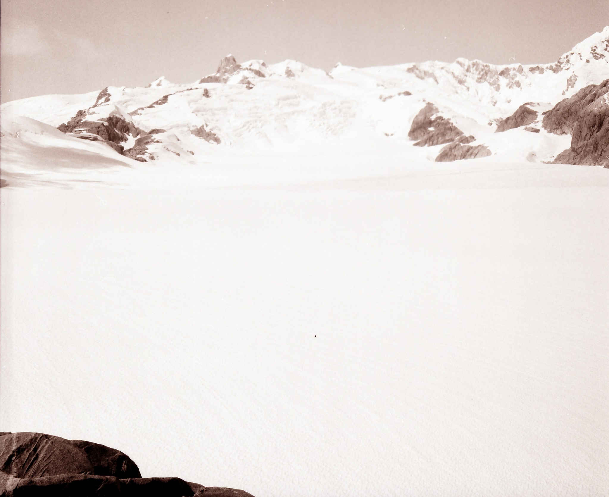
The cogs started to turn and a dream turned into an obsession! The obsession is shown in the 1944 aerial photograph below . . . .
 |
| The Levels superimposed on the 1944 Aerial Photograph of Glacier Benito |
Planning and Preparation
Over the next six years, the plan emerged following discussions with Olaf Wündrich of ColibriVentura and others. The major requirement was to find a helicopter able to undertake the flights. Olaf undertook a project with Discovery Air Chile and discussed the possibility of the flying to Glacier Benito with the pilot, Rodrigo. Meanwhile Martin had several jobs having passed the normal retirement age of 65. So the plan developed in late 2016 to hire a helicopter to take us in and out of the Levels on Glacier Benito. We also need a method to extract ourselves with a helicopter in the event of the helicopter not being available.
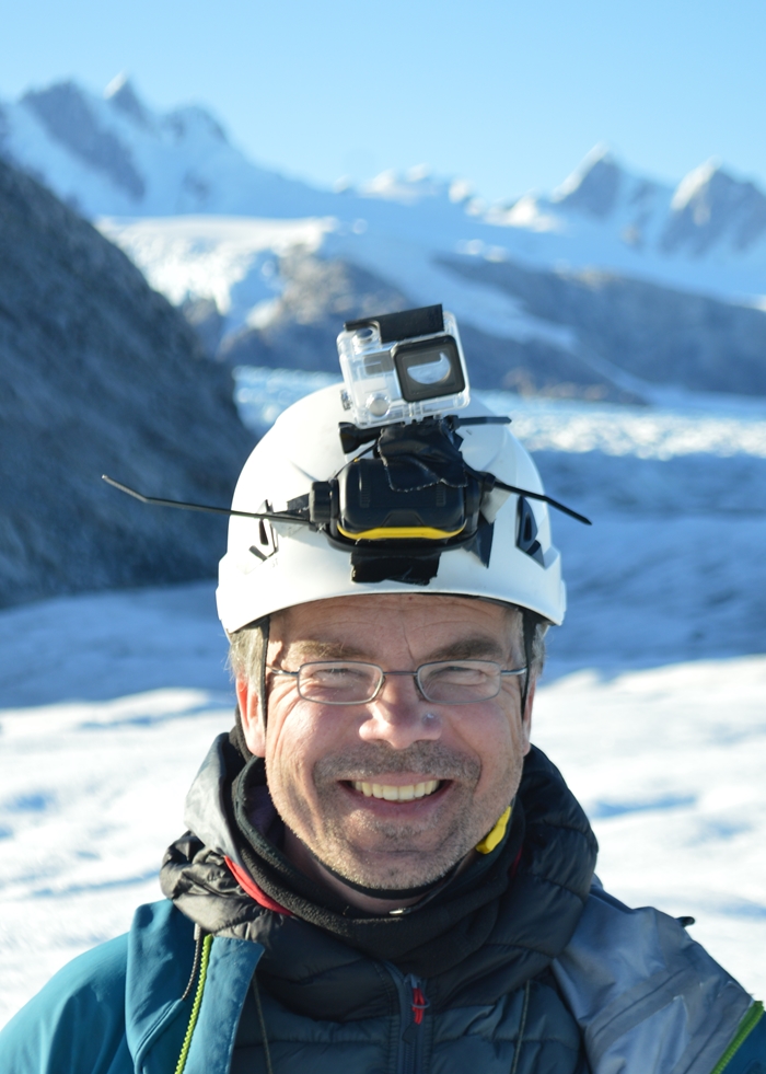 |
| Olaf 2017 |
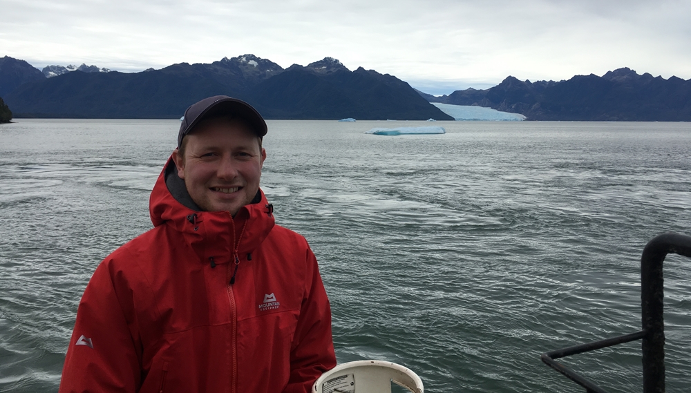
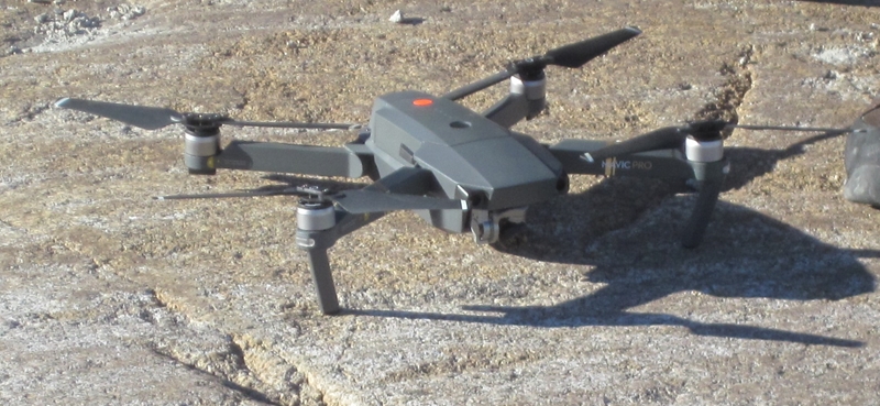
Mark joined the project with the tasks of photography and flying a quadcopter drone on the expedition. He assisted with obtaining equipment and other items needed for the expedition.
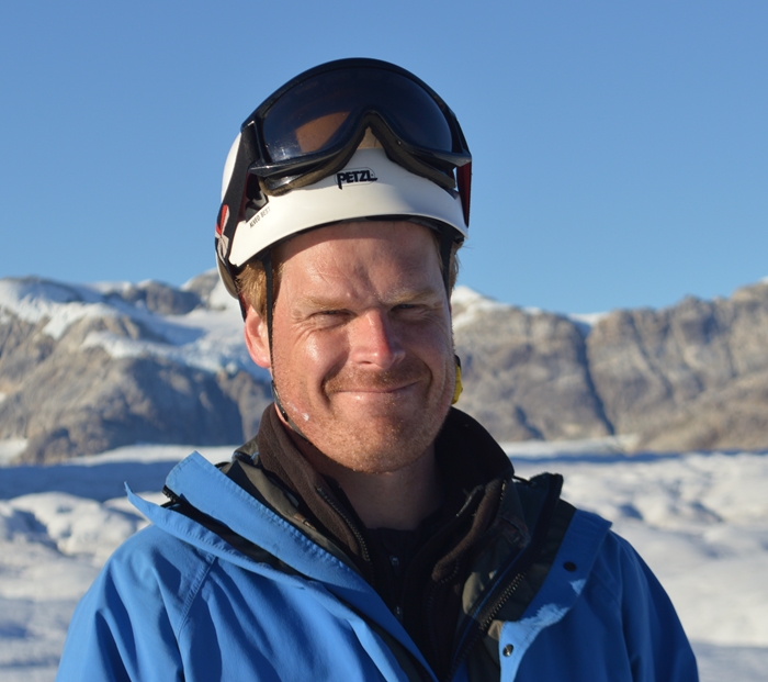 |
| Mark 2017 |
Olaf worked with another Patagonian Guide, Marcos, on Glacier Exploradores early in 2017 and recommended that he should join the expedition. Marcos joined the team so that it could operate as two groups and also provide instruction and training for Martin and Mark.
 |
| Marcos 2017 |
The Glacier Exploradores Expedition involved flying a fixed wing X8 drone under the direction of Professor Alun Hubbard of Aberysthwyth University. So we invited Alun to participate to enhance the data collection but Alun had too many commitments. Instead he recommended that his researcher, Johnny, who does most of the drone flying and subsequent data analysis, participate. As a result Johnny joined to make a five man team.
 |
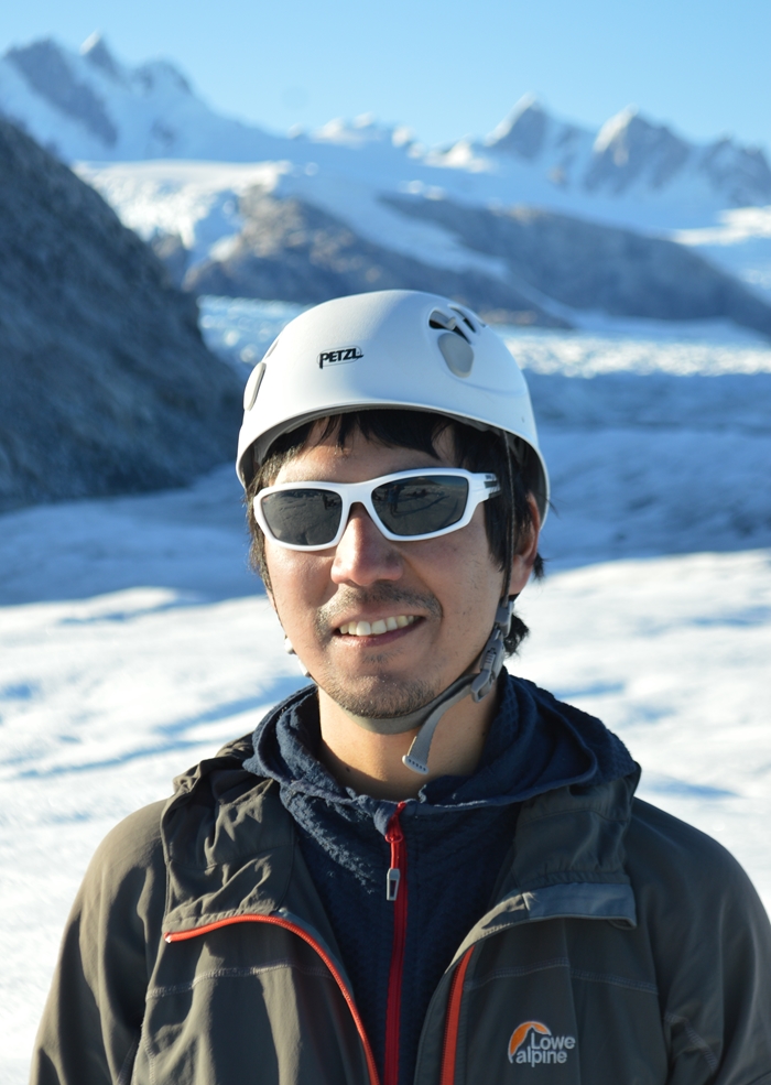
| Johnny 2017 |
Most importantly, Jammie of ColibriVentura was able to facilitate the progress of the expedition through the official channels. Gabriela Gomez of CONAF, Laguna San Rafael National Park, sponsored the expedition for its scientific work.
A difficulty arose in late 2016 and early 2017 in trying to secure the services of the helicopter. The major problem was the serious wild fires that occurred in Regions VI, VII and VIII. which meant that most helicopter resources were being diverted to fight the fires. Once the fires started to die down, we approached Discovery Air Chile in conjunction with Discovery Air Headquarters with our planned start date of 10 April 2017. Discovery Air Chile said they would provide the necessary support. The expedition was on!
 |
 |
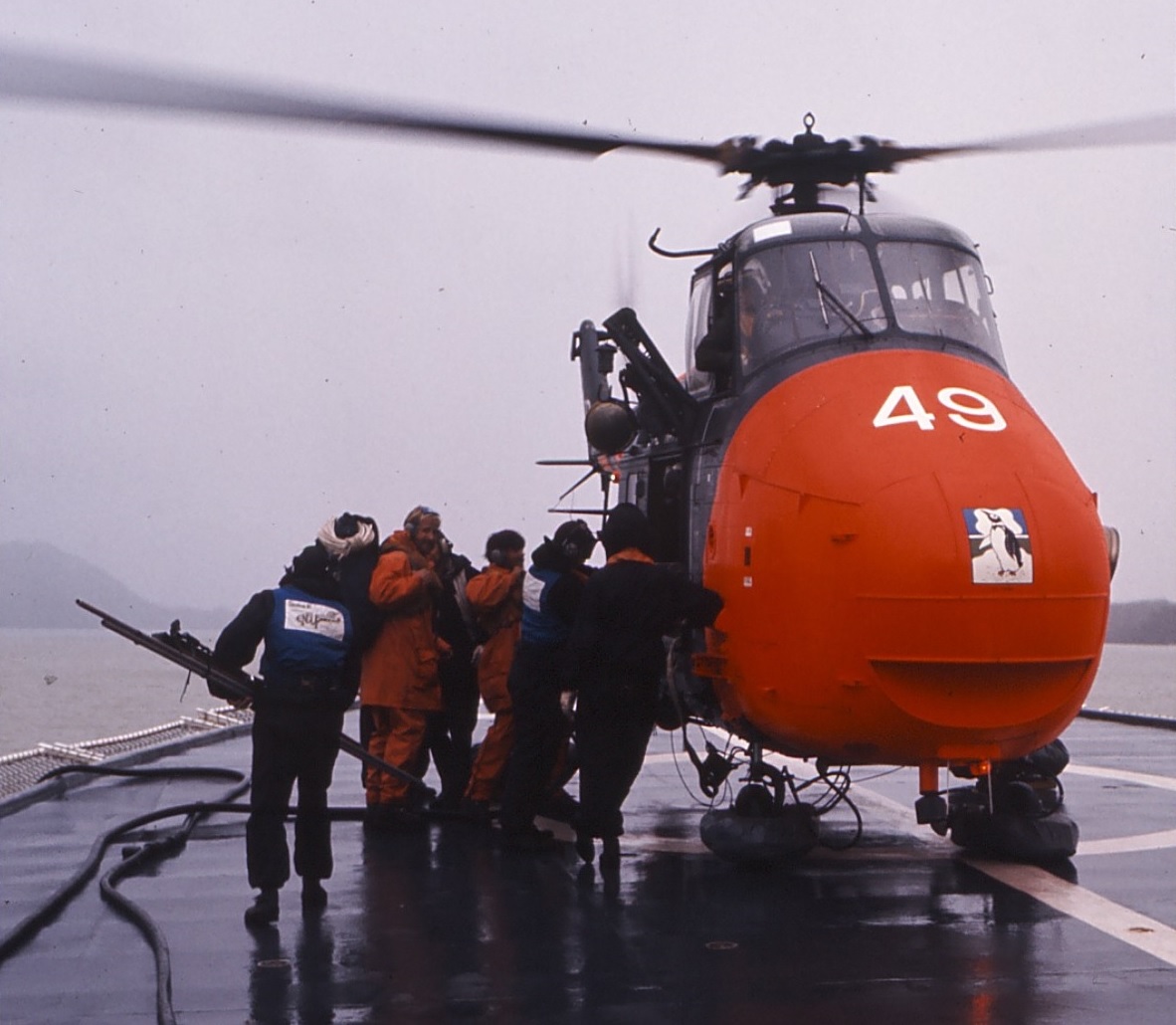
Taking Off for Glacier Benito from HMS Endurance in a Whirlwind
December 1972 |
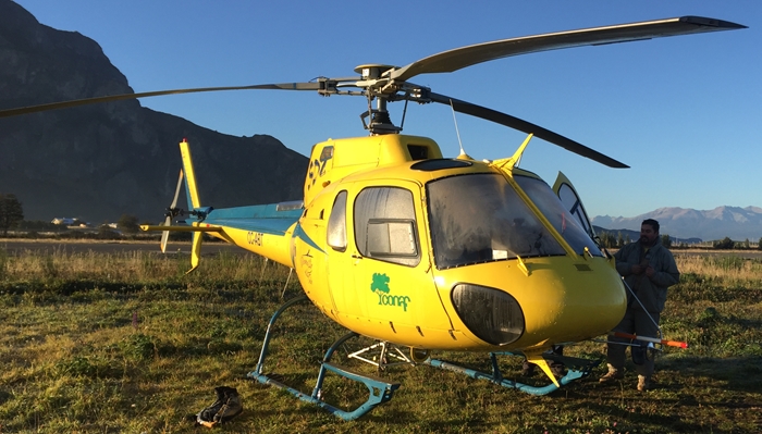
The Discovery Air Helicopter |
Why choose April? Generally most expeditions in the region take place in the summer months (November to March) so April felt a little risky in terms of weather and shorter days. However e-mail correspondence with pilots over the years indicated that supporting expeditions between November and March interfered with their most productive commercial activity and they reckoned the best flying weather west of the Northern Icefield was in April and May. If we wanted to access the glacier by helicopter then we had to trust their judgement . . .
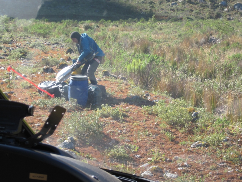
Jammie and Olaf obtained all the necessary approvals in February and March at short notice including a very tricky one of flying drones. They also sorted out all the logistics, including obtaining the necessary kit and food and how to transport eight barrels of aviation fuel 300 km to Laguna San Rafael.
Map of Operations
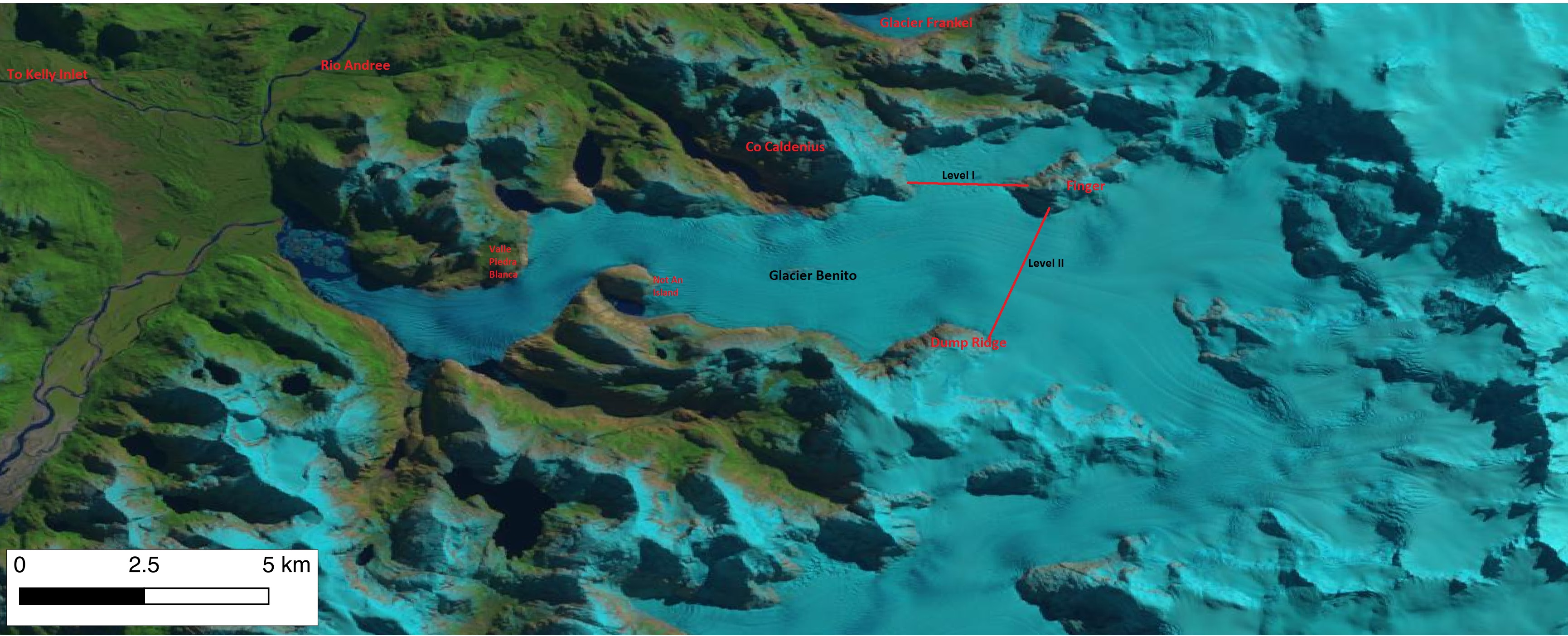 |
| Map of Operations - Glacier Benito (from LandSat 8) |
Execution
Martin arrived in Coyhaique on Saturday 1st April to pack the food and help with some last minute activities. Johnny arrived on 6th April with the X8 drone. Marcos was in town the following day. Meanwhile snow was falling with it settling down to 500 m above sea level (absl). Had winter started early?
At 0730 on Friday 7th, the fuel truck departed with all the kit together with Olaf whilst Jammie took Johnny and the valuable kit such as rucksacks. The aviation fuel drums were loaded on to the truck at Coyhaique aerodrome and both truck and pickup (ute) went to Puerto Chacabuco to arrive at midday. Drums, kit and food were loaded on to the Reloncavi II from Cupquelan whilst Olaf and Johnny were the two passengers. They departed Puerto Chacabuco around 1700.
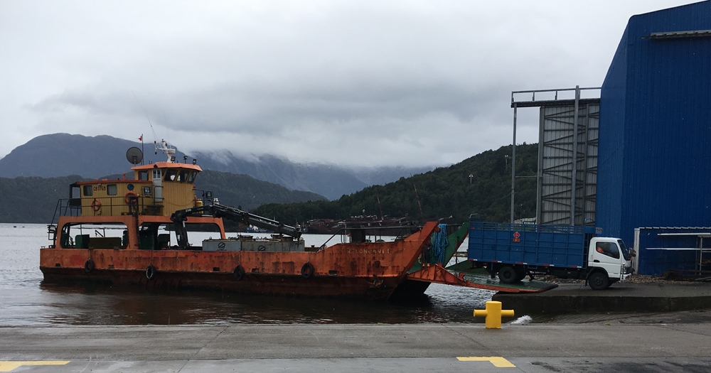 |
| Fuel Truck reversing on to Reloncavi II in Puerto Chacabuco |
They arrived at Laguna San Rafael about midday on the Saturday. The next task was unloading the equipment and fuel.
 |
 |
| Arriving in Laguna San Rafael |
Lifting the Fuel Barrels off the Vessel |
Meanwhile Mark had arrived on Saturday after a short delay due to fog at Balmaceda airport. Rodrigo, the pilot, phoned to say that the flight to the glacier maybe either Tuesday or Wednesday. Jammie printed off a weekly weather report showing a 'high' pressure region developing over the Northern Icefield from Tuesday to the following Monday. Clear sky was indicated by the significant difference in maximum and minimum temperatures for each day. Maybe we were in luck . . .
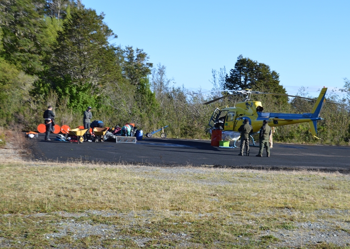
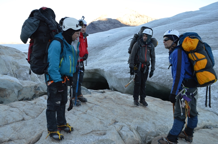
At Laguna San Rafael, the eight barrels were moved from the jetty to the landing strip together with the stores. At expedition HQ, last minute preparations were being undertaken - charging batteries, making tougher boxes for the drones, repairing a leaking pack raft and, most importantly, training for Martin and Mark in glacier walking techniques, roping, extraction from crevasses etc. The pilot rang on Monday to give us the go ahead for Tuesday.
Arriving on Ice - Tuesday 11th April
Then started six magical days . . . .
 |
| The Start of a Beautiful Day |
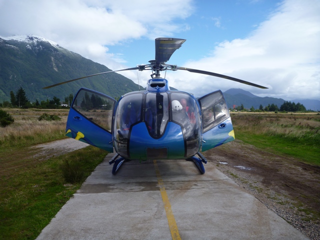
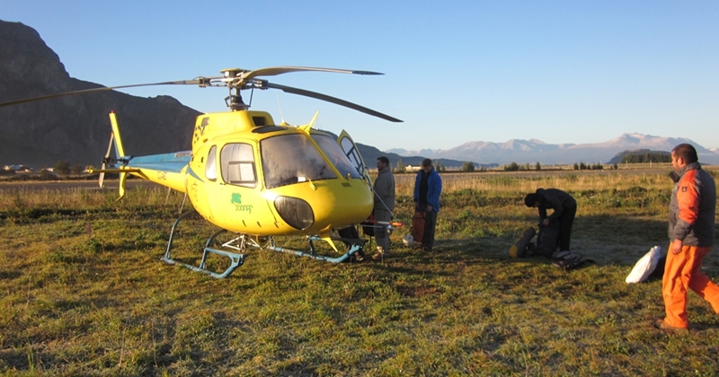
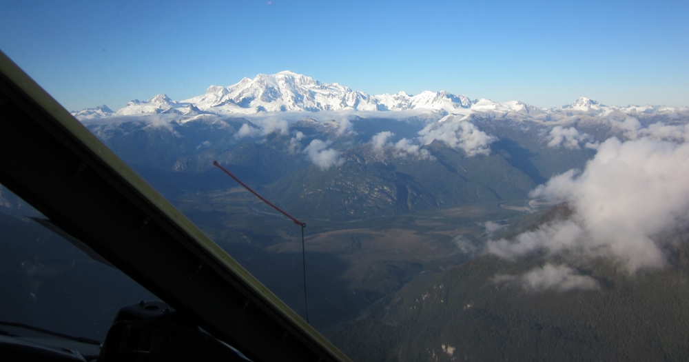
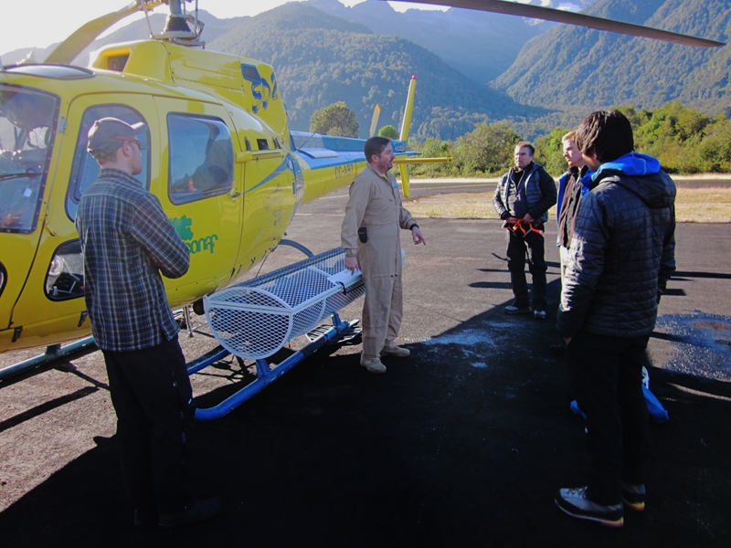
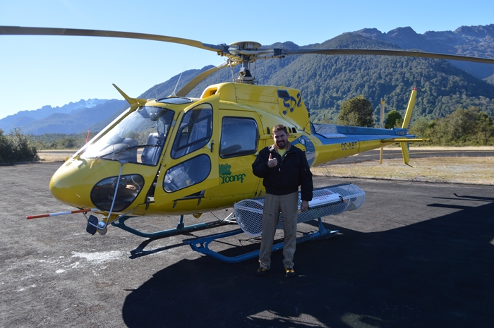
Waking early to a full moon, Jammie took Mark, Marcos and Martin to Coyhaique aerodrome. We met Rodrigo, the pilot of AS350B2 helicopter registration number CC-ABT. After loading the aircraft with the remaining kit followed by a safety briefing, we took off at 0930. We flew directly to Laguna San Rafael in fine weather over the main range, past Vulcan Hudson and other glaciated high peaks, over deep glaciated valleys and within meters of the high ridges. It was breathtaking and absolutely spectacular. We had a great view of Mount San Valentin (4000 m absl approximately).
 |
 |
| Loading the Helicopter at Coyhaique |
Mont San Valentin |
We arrived at Laguna San Rafael at 1030 where bags were reorganised and the helicopter refuelled.
 |
 |
| Kit and Helicopter at Laguna San Rafael |
Safety Briefing at Laguna San Rafael |
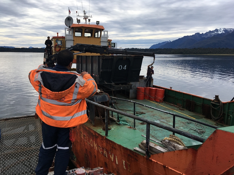
The first stick consisted of Olaf and Martin together with walk out packs and some supplies for the Glacier Benito camp. First stop was Punta Blanca where Olaf took a barrel of food and hid it in the bushes. Second stop, with rotor turning, was the Valle Piedra Blanca (leading to Punta Claus) where the five pack rafts, paddles and second food barrel was left.
 |
 |
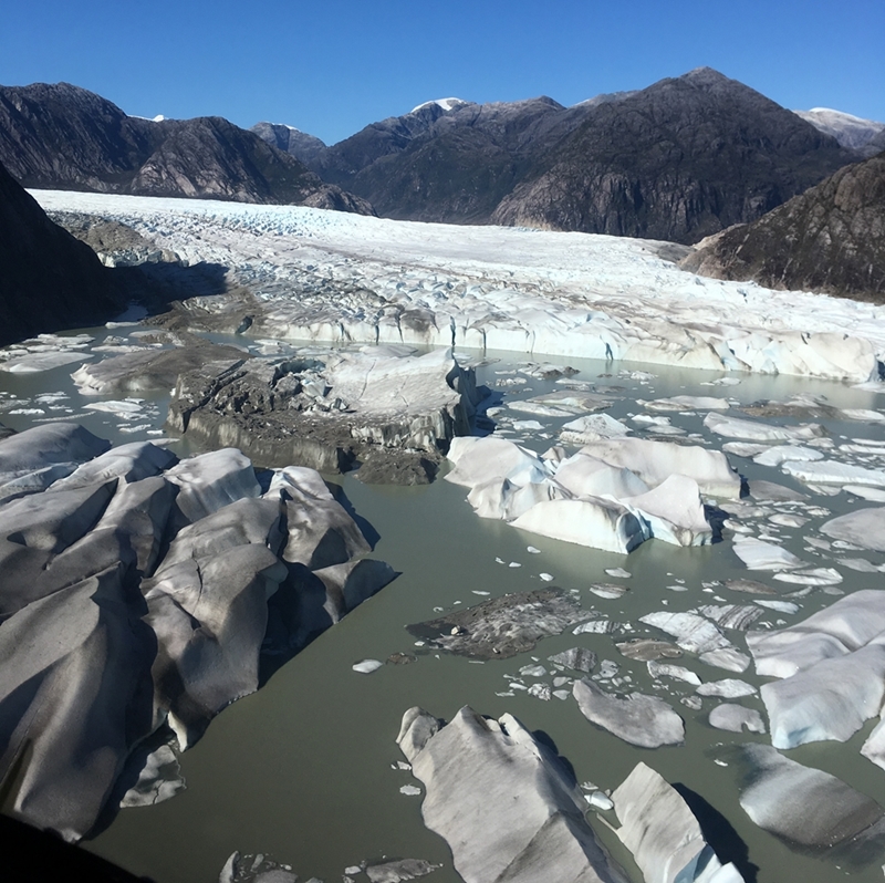
| The Ice Front in Laguna Benito |
Off Loading Walk Out Kit in Valle Piedra Blanca |
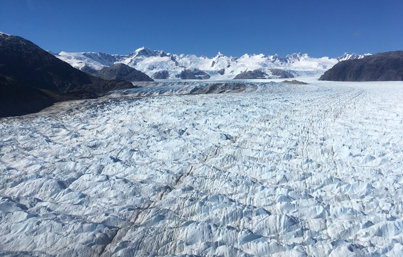
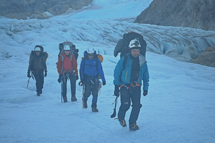
We then flew on up the glacier, past 'Not an Island' and along Dump Ridge looking for a landing spot. No site existed. We flew on to the 'Finger' (El Dedo) where we tried to land on freshly exposed rock (too steep) followed by freshly exposed scree (too steep)! We went to the Co Caldenius ridge but there was no viable landing site there. We returned to the Finger and settled down on a fresh, flat area of the ice. With the rotor still turning, the remaining stores were removed from the helicopter, before it flew directly over the northern ridge and back to Laguna San Rafael. Just over an hour later, Mark, Marcos and Johnny arrived with the remainder of the kit including the X8 drone box.
 |
 |
| Flying up Glacier Benito |
The Second Stick Arrives |
NOTE: Co Caldenius was known as Co Alpha during the 1972/73 Expedition but was named by Hugo Pallin as Co Caldenius in the 1921/22 Expedition (private communication Camilo Rada/Martin Sessions).
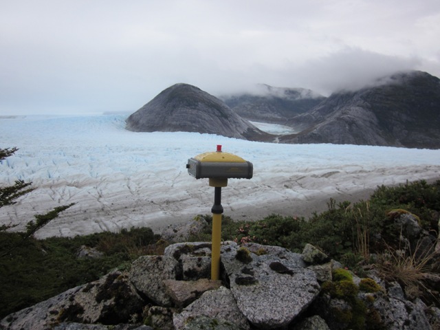
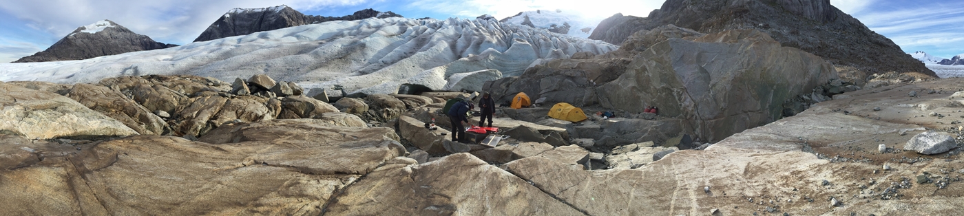
We moved all the kit to freshly exposed rock on the Finger in two loads. A suitable campsite was selected (with a slight slope!). Nearby was a pond for fresh water and another one for washing our cooking and eating utensils. We even had a rock shelf to cook on standing up. Tents were pitched, a brew made, base GPS station established and so on. Camp was about 670 m absl.
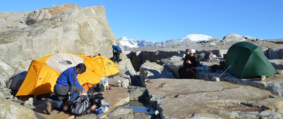 |
| Base Camp at the Finger |
 |
| This Area was under Ice in 2013 |
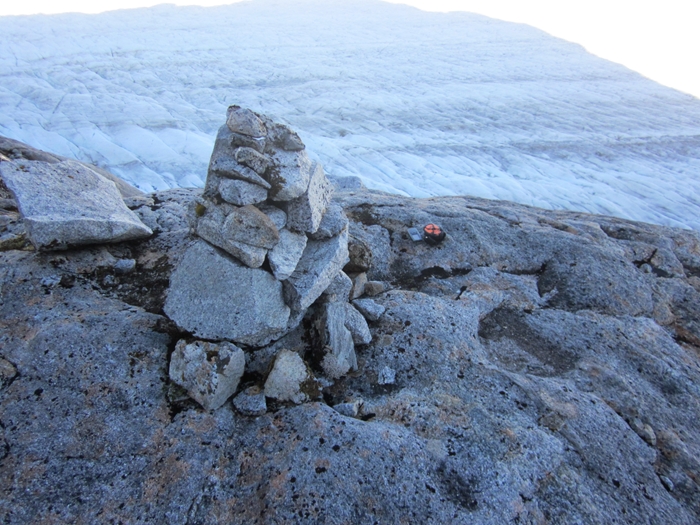
Marcos and Martin then went up the Finger to find the Level I lower cairn which we did fairly quickly at about 830 m absl.
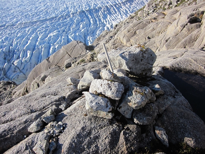 |
| The First Cairn - Level I Finger Lower |
So what had changed between 1973 and 2017 . . .
 |
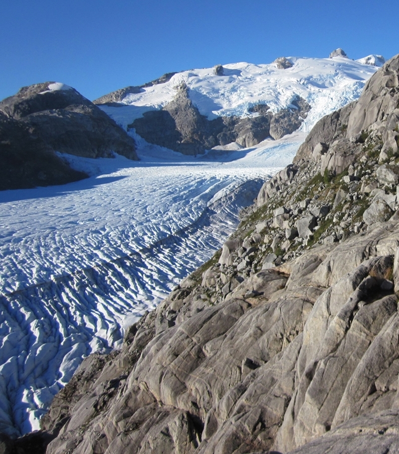 |
| View up Glacier from Cairn in March 1973 |
View up Glacier from Cairn in April 2017 |
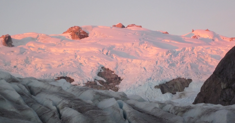
Our first day was simply beautiful with no clouds, stunning views and no wind. We were extremely lucky to have such conditions to settle in at our new camp for six days.
 |
|
Lengthening Shadows on our First Day |
Preparing for Drone Flights - Wednesday 12th April
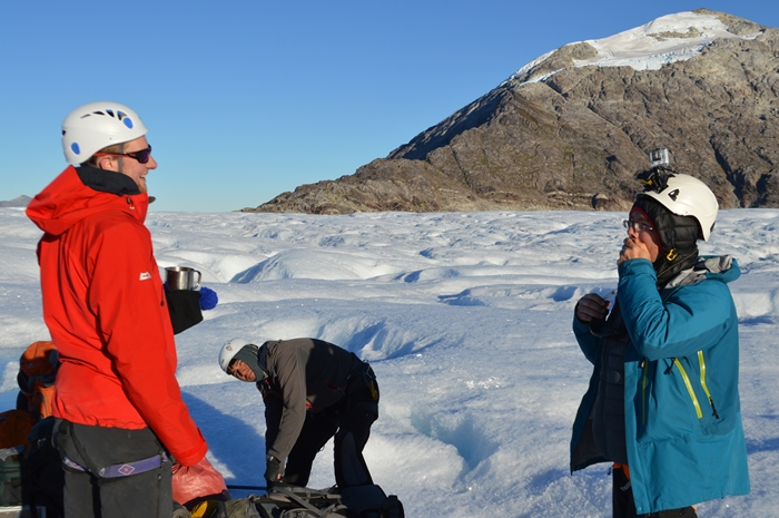
Each morning's activity started with Martin getting up at about 0730 to light the cookers. The ground and glacier were frosted. As soon as we left the tent, the condensation inside the tent also turned to ice which fell onto our sleeping bags and mattresses as we entered the tent again to get items required during the day.
With JetBoil cookers, it did not take long to boil the water, provided the gas canisters were warmed in the sleeping bag first. The rest of the team arose promptly at 0800 although it was still quite dark. We were assisted by the bright near full moon in the early morning.
Mark and Marcos went up the Finger to find the cairns for Level II. They found one cairn which was great news.
 |
 |
| Level II Finger Lower Cairn |
Starting the Base Station |
Johnny worked on preparing the X8 drone.
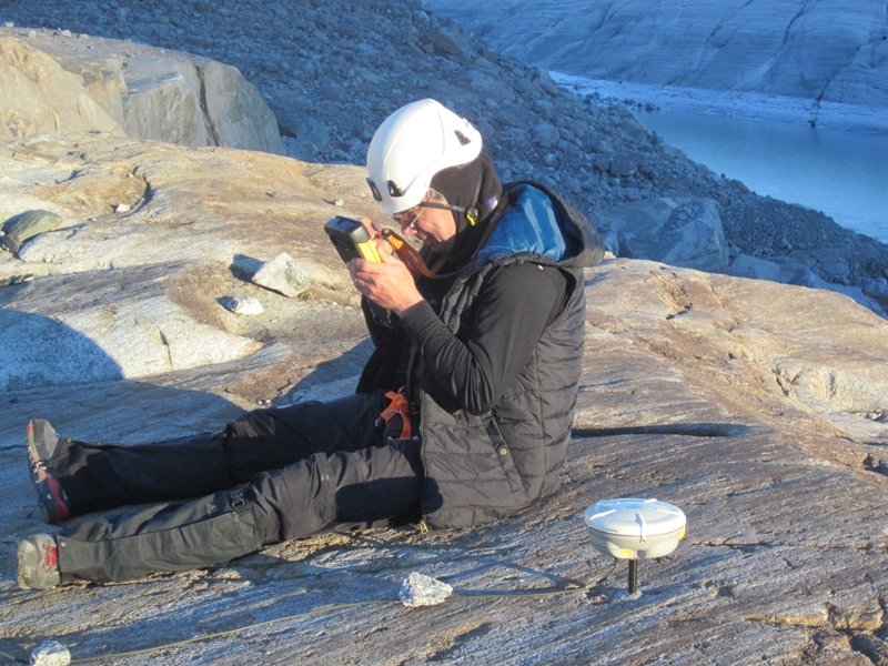
Each morning Olaf started the Base Station near the camp site. Afterwards, at 1030, Olaf and Martin walked towards Dump ridge, positioning seven one meter square markers on the glacier to provide reference points for the X8 drone survey. The GPS base station had been set up before Olaf and Martin set off to improve the accuracy of the measured points. We returned at 1630.
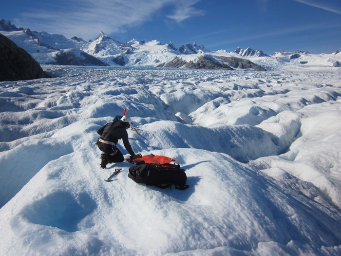 |
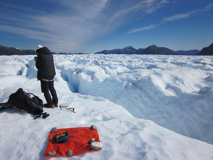 |
| Placing a Marker on the Glacier for the Drone Flight |
The Further we walked across the Glacier, the deeper the Crevasses |
 |
 |
| The Stunning Backdrop |
The 'Eagle' |
The X8 drone was supposed to fly that afternoon but a number of technical problems prevented the planned flight. A number of work arounds were made and the motor ran on the last test of the day.
 |
 |
| Drone Launch Attempt |
Drone Launch Attempt |
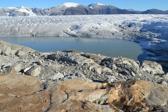
An interesting event occurred during the day when the small lake at the end of the Finger emptied totally in about 12 hours!
 |
 |
| The Lake at the end of the Finger |
Where has the Lake Gone? |
Sundown occurred around 1930 but the sun went behind Co Caldenius just after 1800. We spent a few minutes after sunset observing satellites 'fly' across the sky. Our second day was simply beautiful with no clouds, stunning views and no wind.
 |
| The Ice turned Red briefly for a few minutes |
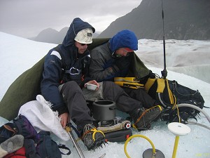
Finding the Level Markers - Thursday 13th April
Day three started the same as day two. Clear sky, moon providing the illumination before dawn, a sharp frost and no wind! Johnny, Olaf and Mark remained in camp to try to get the X8 drone up and flying.
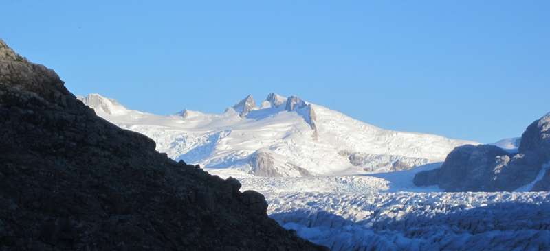
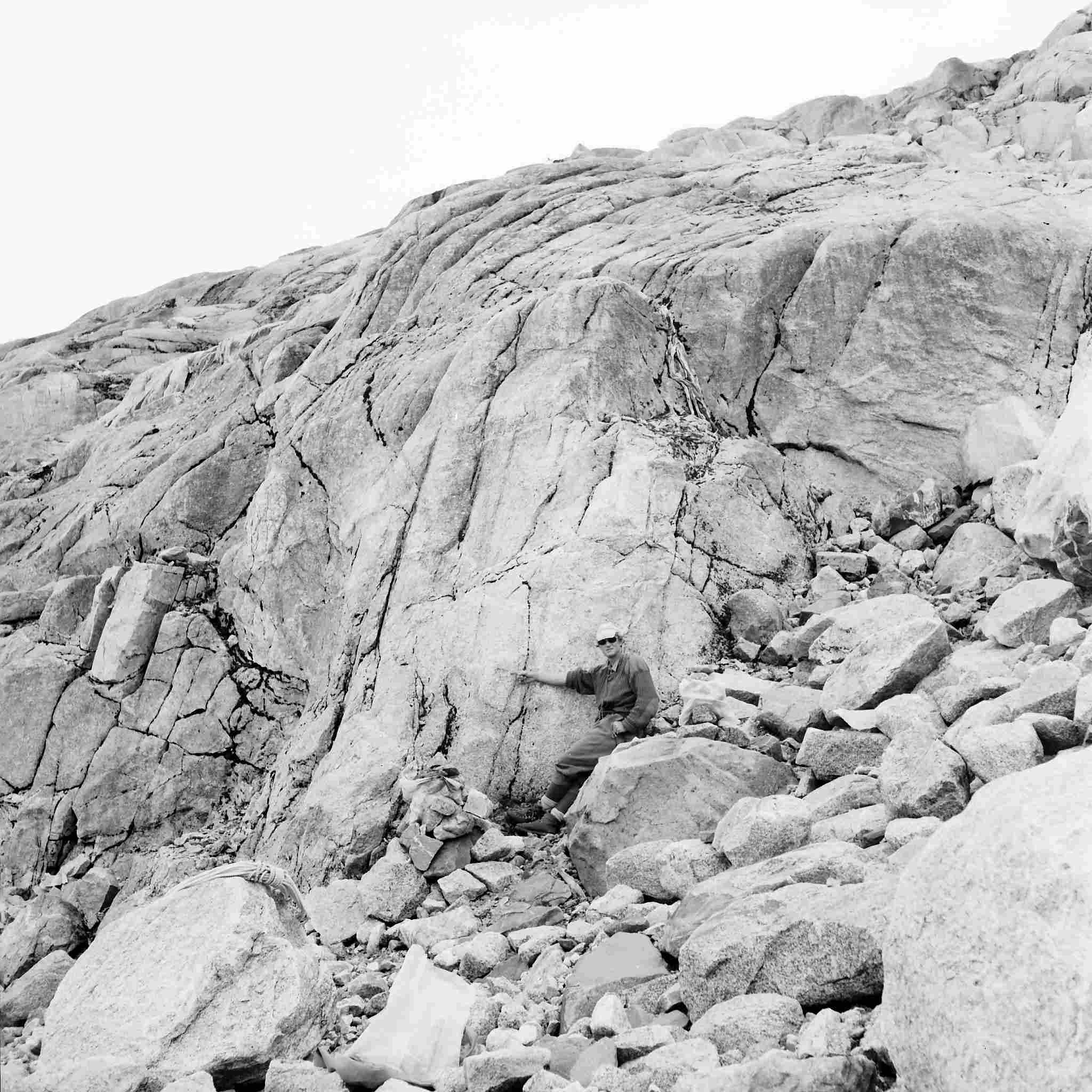
Marcos took Martin up the steep side of the Finger to view Level II lower cairn. We arrived at the ledge where the cairn was sited to find it in good shape. There was no bench mark evident and the upper two markers could not be found. There was evidence of significant rock fracturing, and, as the upper two markers had been built on 20 degree plus slopes, it was highly likely that they were swept away. The altitude of the Level II Finger lower cairn was about 835 m absl which corresponded approximately with that measured in February 1973.
 |
 |
| View from Level II Finger Lower Cairn towards the Bench Mark - Mar 1973 |
View from Level II Finger Lower Cairn towards the Bench Mark - Apr 2017 |
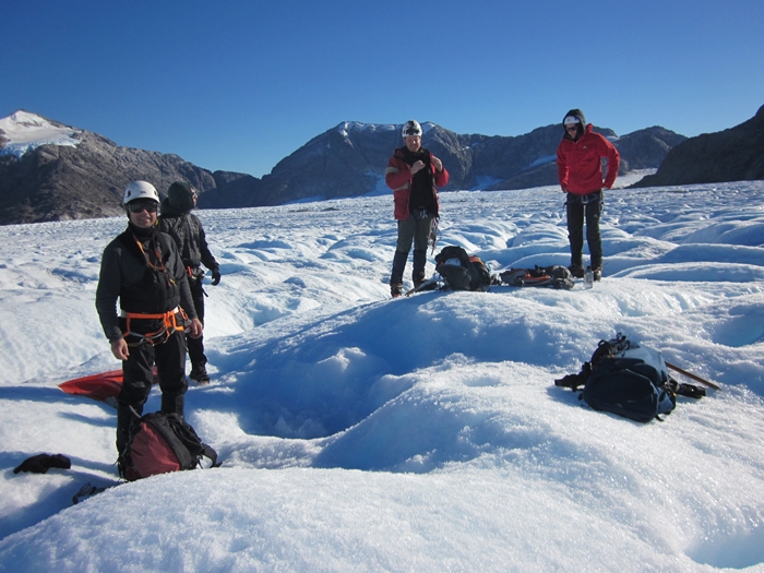
Marcos and Martin returned to camp. Problems still bedevilled the X8 drone so, after lunch, we left Johnny, Olaf and Mark to continue with the investigation and testing. We crossed the glacier along the line of Level I to the Co Caldenius ridge. Pausing briefly to take crampons off, we climbed up a wide gulley to the ridge line then followed up that until we found the upper Co Caldenius cairn. We then climbed down the side of the ridge a little to find the ledge where the survey had terminated. We fixed the points with GPS then returned to glacier taking photographs on the way down.
 |
| Level I Co Caldenius Upper Cairn |
 |
 |
| View from Level I Co Caldenius Upper Cairn looking East - Feb 1973 |
View from Level I Co Caldenius Upper Cairn looking East - Apr 2017 |
Whilst we were on the ridge we observed the Mavic drone in our vicinity. We returned to camp at about 1700.
Unfortunately Johnny, Olaf and Mark could not get the X8 drone to have enough propeller power to fly so it was put to 'bed'.
.jpg) |
 |
| Launching the X8 Drone on the 2nd Day |
Retrieving the X8 Drone from an Ice Hole |
Mark and Johnny then flew the Mavic for a test flight followed by going across the glacier viewing Level I. A couple of technical issues required resolving. With the X8 drone no longer in action, we had plenty of LiPo battery power to charge the Mavic drone batteries but they would not charge. A satellite phone call to Ben in Australia established what the problem was - the LiPo batteries had to be discharged slightly to under 16 Volts before they could be used. The GPS base station was used to discharge the LiPo batteries.
 |
.jpg) |
| Mavic into Action |
View of the Camp on the Test Flight |
 |
| The Mavic |
That evening with the moon rising later, we were able to marvel at the incredible night sky. For Martin, this was wonderful as he recently had the cataract affected lenses in his eyes replaced. Still no clouds, stunning views and no wind.
 |
| Writing Diaries in Tents |
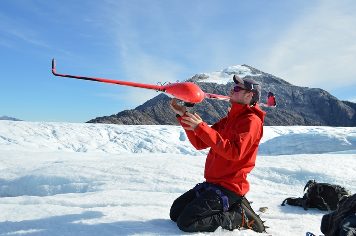
Crossing the Glacier and the Mavic Takes Off - Friday 14th April
The plan on Friday was conduct Mavic drone flying from the middle of Level II on the glacier. So at 0945, all five of us set off to point '403'.
 |
| A brief pause in the walk to point '403' |
On arrival Mark with Johnny and Marcos stayed at the point to fly some Mavic drone flights. Mark had the controls whilst Johnny reviewed the mission plan with directions, intent, primary and secondary objectives, planned heights, flyout bearing (worked out by Marcos), latitude and longuitude of waypoints and so on. Johnny provided subject matter expertise in the 'observer' role including points of interest to the science community (how the glacier stops flowing at the bottom of the Finger, and the need to have angle down photogoraphs to leave out the sky for mapping purposes, etc).
.jpg) |
 |
| Mavic about to take off from point '403' |
Mavic examining Dump Ridge where there might be a sledge from 1973 |
The first flight was to Dump Cairn area to see if the cairn or a sledge could be seen and to take a panorama in the vicinity. Continuing on that mission, the drone was then flown to the position of Stake 10 in 1972/73 for a further panorama. However at this stage the battery was running down so a photographic panorama was undertaken as the drone was returning to base which it does automatically once the battery starts getting flat! The second mission was to fly to the Level II Cairn at the Finger which was completed satisfactorily. A third flight was made down glacier from point '403' towards 'Not an Island'.
.jpg) |
.jpg) |
| Goodbye Drone |
The Drone Returns to the Red Panel Surveyed by Olaf earlier |
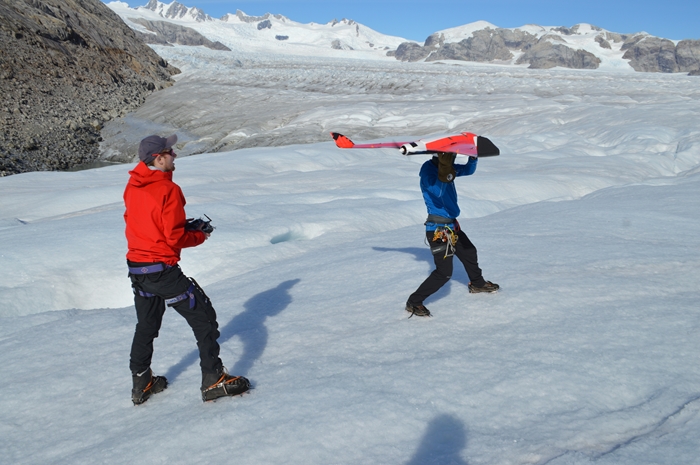
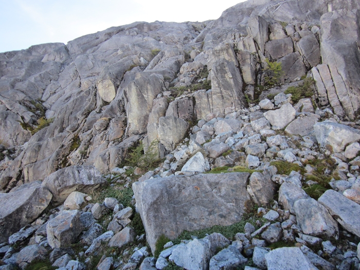
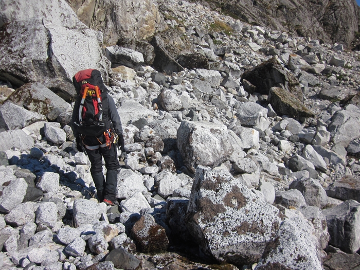
Meanwhile Olaf and Martin continued across the glacier to the vicinity of Level II cairns on Dump Ridge. Progress became slower as we approached the ridge as the crevasses were getting wider and running at an inconvenient angle to the direction of travel. Eventually we made it to the edge of the glacier at 1400. Next problem was how to ascend the ridge because the rocky slope was steep and cluttered with unstable broken rock. Eventually we ascended to 790 m absl before deciding to call it a day because further ascent was too difficult. In fact the cairns, if they still exist, are further east of the former snow gulley. The high point was marked with GPS before we left the ridge to return to camp. On the way back, the Trimble GPS was running in rover mode to get a current profile of the glacier along Level II. We chose to follow the line of the crevasses for while going higher up the glacier before dropping down to take a direct line back to camp, arriving there at 1745.
.jpg) |
 |
| Olaf and Martin Continue to Dump Ridge |
Another Peak is revealed as we cross the glacier |
 |
 |
| The rock covered slope of Dump Ridge |
Climbing Back down the '1972 Snow Gulley' |
On the way back, we were buzzed by the Mavic!
.jpg) |
| The Mavic following Olaf and Martin |
Winding Up - Saturday 15th April
First excursion in the morning was by Marcos and Olaf to Level II Finger Lower Cairn to measure its position using the Survey GPS. After that they moved to Level I Finger Lower Cairn to repeat the survey activity.
In the meantime, Mark and Johnny undertook a drone flight over the ridge to the North to view a route that John, Angus and Martin took in 1972 to Glacier Frankei and then on to that expedition's Advance Base Camp. In the process, the drone only just cleared the ridge. Mark and Johnny established that the drone's ceiling was limited to 500 m above take off height by its software.
.jpg) |
 |
| View of Glacier Frankie in Middle Distance |
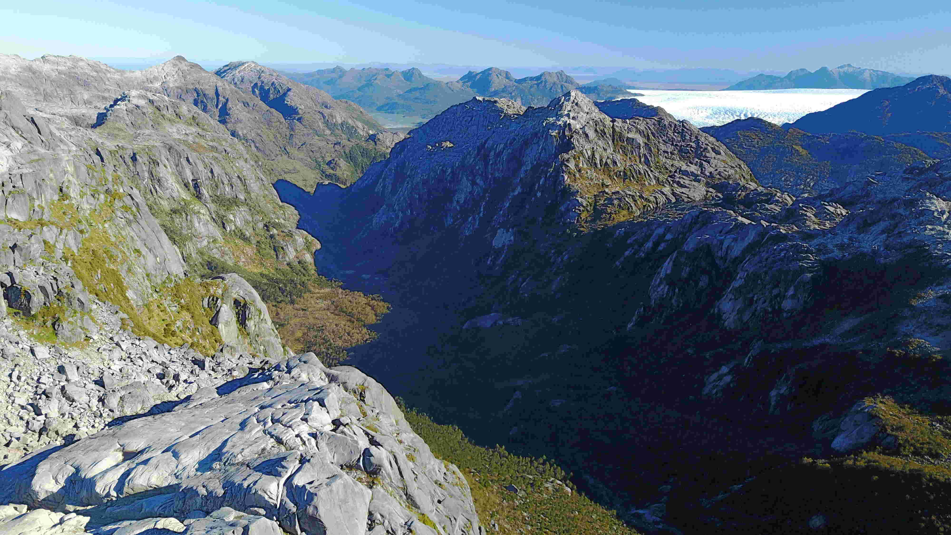
View over the Ridge to the North of Glacier Benito towards Glacier San Quintin |
At 1300, we regrouped and went on to the glacier. Marcos, Mark and Johnny went to fly the Mavic drone from a medial moraine on the glacier. They repeated the flight to Stake 10 and also undertook a survey of Dump Ridge in the vicinity of where Level II cairns should be. Total flight distance in this case was 9.27 km, close to the Mavic's limit of 10 km.
Olaf and Martin recovered four orange marker panels still remaining on the glacier. For some reason our magnetic compasses were swinging violently as we walked across the glacier so we went off route on a couple of occasions. Zigzagging across the glacier, we returned to camp at 1700 to find that camp was unoccupied.
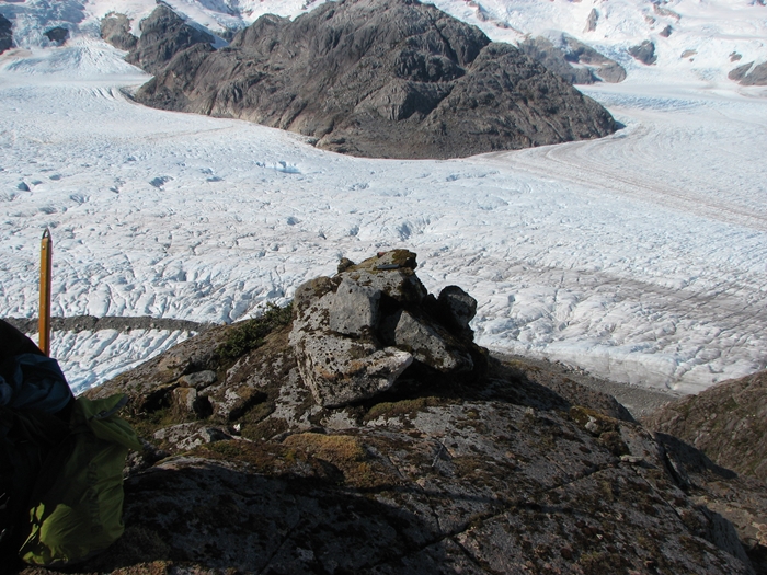
Marcos, Mark and Johnny had climbed up the Finger to above the Level I Finger cairn in order to gain additional altitude so that the drone could fly to the top of Co Caldenius and the Finger. The flight to the top of Co Caldenius was about three kms each way and the drone had to reach 1300 m absl which it did just. At the top of each point, panoramas were taken for comparison with photographs taken in 1973. As the trio returned to camp, they found the upper cairn and marker for Level I Finger.
.jpg) |
 |
| The Mavic approaches the Summit of Co Caldenius |
The Upper Marker for Level I Finger was still intact |
Departure - Sunday 16th April
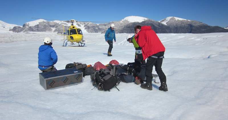
The weather was still excellent for our final day for departure. Martin was tempted to stay one day longer but one should not tempt 'fate' even if the weather on Monday was going to be good.
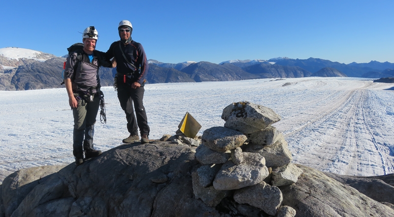
We made an early start and were ready to move out to the landing zone on the glacier at 0830 with all equipment packed and the camp site cleaned up. Two load carries each later, we were already to receive the helicopter at 0930. The next 30 minutes were spent having a quick brew, taking photographs including a group photograph and having a last walk around on the glacier.
 |
 |
| Vacating our Camp Site |
En Route to the Landing Site |
 |
 |
| The Landing Pad |
Brew Time |
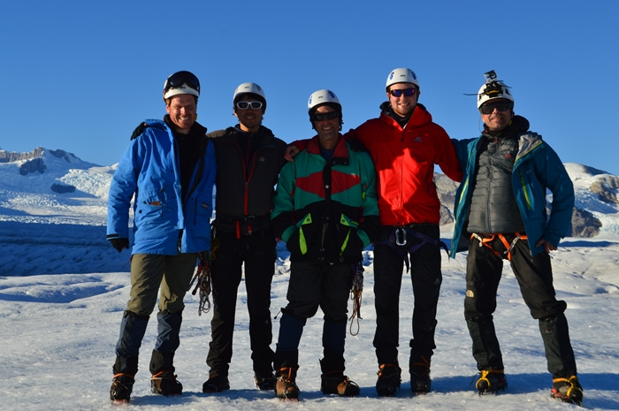 |
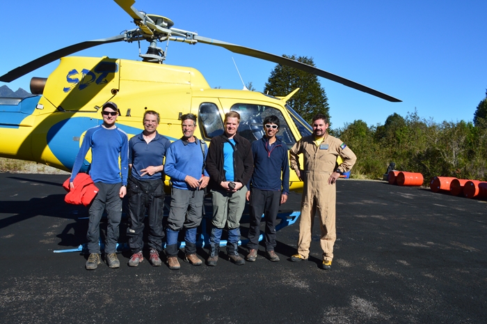
| The Team |
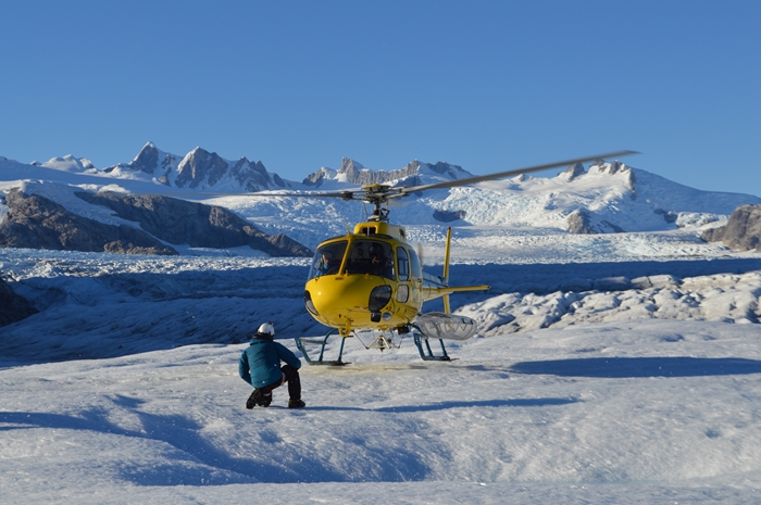
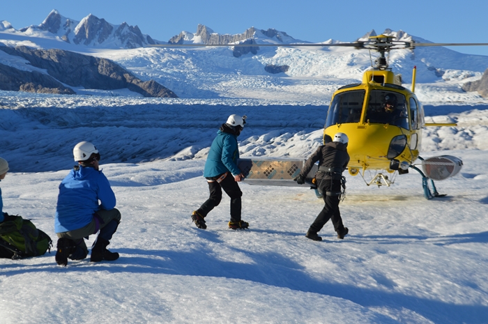
The helicopter CC-ABT, piloted by Rodrigo, arrived at 1015 with Gabriela. Olaf loaded the helicopter before Mark, Marcos and Johnny boarded for the trip to Laguna San Rafael.
 |
 |
| The Helicopter Arrives |
Loading the Helicopter |
Olaf described to Gabriela what we were doing here and we took some more photographs. 75 minutes later the helicopter returned to pick us up. We flew down the glacier to pick up the walk out kit at Valle Piedra Blanca, followed by a second pick up at Punta Blanca. We crossed Kelly Inlet again where we saw a two masted schooner in the bay with the crew rowing ashore to Isla Boscosa in a rubber boat. After that we climbed the north side of Kelly Inlet to fly around Pallin's Survey point twice before returning across Glacier San Quintin to the Laguna San Rafael airstrip.
 |
 |
| Gabriela with Olaf |
Recovery of Walk Out Packs from Valle Piedra Blanca |
 |
| A Last Very Small Glimpse of Glacier Benito from near Pallin's Survey Point |
On arrival, the helicopter was refuelled before taking off with Martin, Mark and Johnny with Gabriela for Coyhaique. We flew past Volcan Hudson but kept clear due to ash being whipped up by winds. The pilot used the valleys to reduce the effect of the head wind. We landed at Coyhaique at 1500. Mark flew back to Australia a couple of days later whilst Johnny researched studies on Patagonian Icefields' glaciers. He ascertained that there were few published field studies undertaken at the higher altitudes of the glaciers and indeed only one published 'levelling' study on a Patagonian Icefield glacier.
 |
 |
| Rodrigo Our Pilot |
Ready for Our Return to Coyhaique |
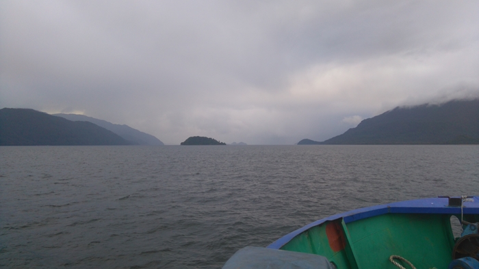
Meanwhile Olaf and Marcos were waiting for a lift out by ship from Laguna San Rafael. After seven days waiting, the Cupquelan support vessel Saurak picked them up from the Laguna San Rafael jetty on Sunday 23rd. They arrived at Puerto Chacabuco on the following day and were in Coyhaique at 1700.
 |
| The Saurak on the way to Puerto Chacabuco |
Observation - The Glacier is Changing Quickly
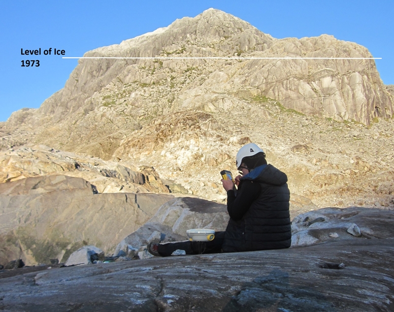
As Martin stood on the recently exposed rock at the Finger camp, he looked up at the Finger Level I Lower Cairn, over 150 metres above him. The altitude of this cairn was similar to the average surface elevation of the glacier measured across the 'Levels' in February 1973. In the 44 years since, the glacier has thinned considerably and continues to thin each year. As demonstrated in many scientific papers, the thinning is due to significant changes in climate including higher annual average temperatures and alteration to the precipitation that arrives to sustain the west flowing glaciers. Martin realised how lucky he was to have observed the glacier in 1972/73 and to have photographed the glacier extensively then so that he is able to show to others one of the demonstratable effects of climate change. View the photographs that show the changes in the galcier between 1973 and 2017 HERE.
 |
| Approximate Position of Glacier Ice Surface in 1973 |
Final Words
What an amazing six days, never to be repeated.
.jpg) |
| The Backdrop |
Acknowledgements
Some of the organisations and people we wish to acknowledge for making this venture possible:
- La Corporación Nacional Forestal (CONAF), Dirección Regional de Aysén
- ColibriVentura
- Martin Sessions & Associates
- Discovery Air Innovations Chile
- Rodrigo Espinoza, Our Pilot
- Aberysthwyth University
- Salmones Cupquelan S. Ar.
- The Master and Crew of Reloncavi II
- The Owner, Master and Crew of Saurak
- Laguna San Rafael National Park
- Sir Crispin Agnew and all members of 1972/73 Joint Services Expedition to Chilean Patagonia
- Graham Hornsey and Brian Reid
- Juan De Rays and Silvio Vera (Transport of Fuel and Equipment)