 |
 |
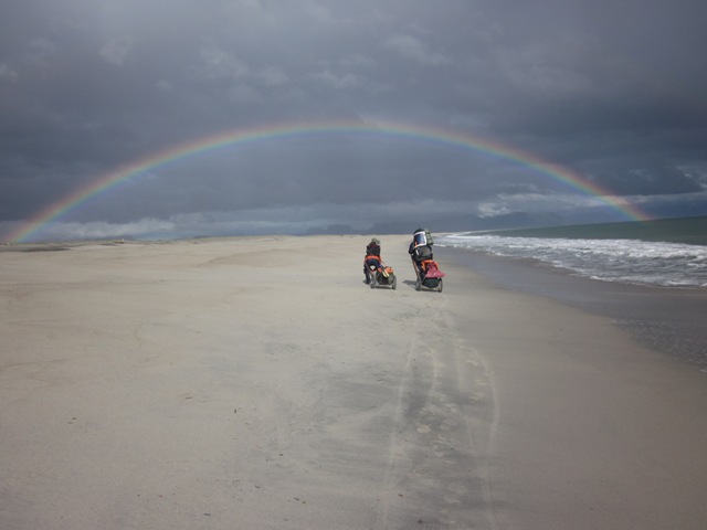
| Towing our Trolleys along the “San Quintin” Beach |
Tracks Mar 2nd to Mar 4th* |
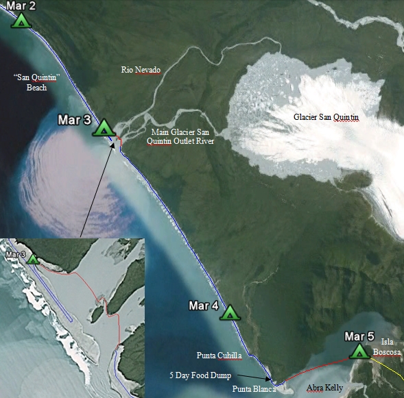
Friday 4th. At low tide, with reduced river flow and no wind, conditions were good for the river crossing. The far side of Rio Nevado, the main Glacier San Quintin outlet river, was reached without incident, using an island in the middle to reposition ourselves up stream again for the second leg where the stream was much stronger. By 11:00 we were towing our carts again. Initial progress was good as firm sand was found alongside the marshland but then we were forced back on to the soft sand of the beach. The views of the main range, including Mt San Valentin, were very good. At 18:30, we stopped for the day after crossing yet another small stream, draining the marshland.
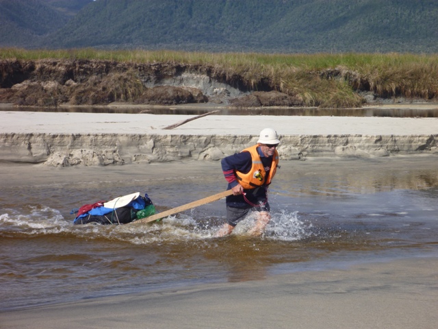 |
| Crossing a small river as it flows across the San Quintin Beach |
Saturday 5th was an even better day than Friday for the views of Glacier San Quintin and the mountain range behind! After towing our carts for two km, we reached a larger river than the streams that we had crossed the previous afternoon at Punta Cuchillo so we had to boat all the bags across the river. We went on for another hour where we found a large dune where we could bury five days of food for the return journey. At 14:00 we arrived at the Abra Kelly side of Punta Blanca. Embarking in our packrafts after leaving the carts in the bushes, we crossed the inlet to Isla Boscosa in just over an hour due to a following sea breeze. That night we camped at the 2007 expedition base campsite.
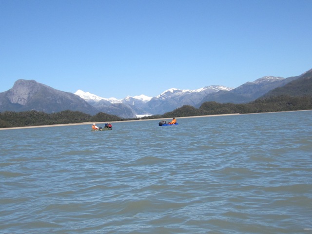 |
| Our First View of Glacier Benito as we crossed Abra Kelly in the Pack Rafts |
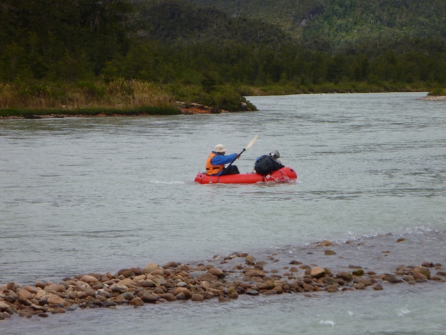
Sunday 6th. We made a double load carry to Rio Andree, in two stages. The first load carry was to the first river crossing point (Rio 1), then we returned to the campsite to pack the tent and carry our rucksacks all the way through to the second river crossing point (Rio 2). We made better time on the second trip as we were able to find the optimum route used in 2007. Whilst about to cross a small tributary of Rio Andree, Martin remarked to Peter that he could not find the mysterious rope that had been found in 2007 at the first crossing. Peter said “was this it?” picking up a rope and giving it a tug. It was unattached so Peter fell off the bank into the waist deep water, executing a superb roll in the process to land on his back with the rucksack breaking his fall!
By 16:45, we had assembled all our kit on the north river back ready for another water journey using our blow up rafts. The fast flowing river was crossed without incident then we “bush wacked” for about 500 m to the Slimy Creek campsite where the stream meets a minor arm of Rio Andree.
 |
 |
| Crossing the Andree River |
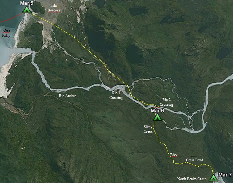
Route from Kelly Inlet to Glacier Benito* |
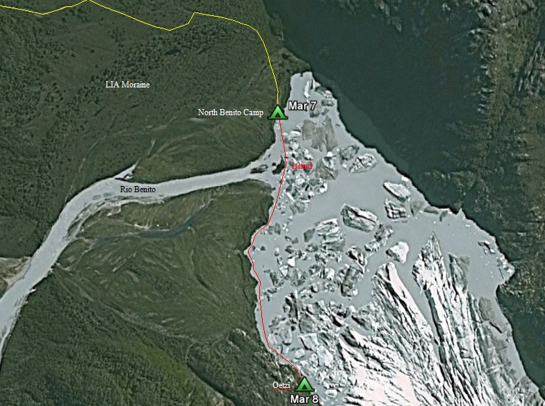
Monday 7th. We tried to use our packrafts up Slimy Creek but gave up after about 300 m. A double lift was made to ‘Bivy’, wading along the stream, then at 13:00 commenced the double lift to the North Benito camp. We were able to find some of the 2007 track but had to force our way through some thick bush near the LIA moraine where we could not pick up the old track. On our way back from dropping the first load at the glacier terminus, we found an important section of the 2007 route so the going was much easier. That night Olaf talked to ONEMI, the region’s emergency service organisation, as he was unable to raise Jammie, who was on the road returning from Puerto Aysen.
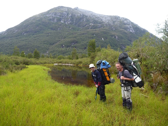 |
| At Cress Pond, load carrying on the second stage to Glacier Benito |
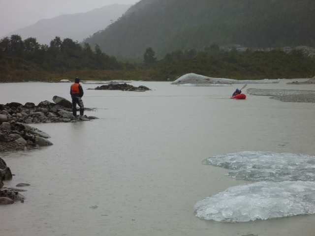
Tuesday 8th saw the end to the fine weather. After blowing up our rafts for the sixth time, we commenced the crossing of Lago Benito to the south side of the valley. Floating ice forced us close to the outlet river and Peter was caught in the current as he made the crossing. He managed to grab hold of the end boulder of the end island and held on to that whilst Olaf expertly threw a throw rope to tow him out of the current. Further on, Martin realised he had left his ice axe behind, not a good day, so we beached where we could not continue any further, unloaded the boats, and returned to the island whilst Martin furiously made the double crossing of the stream to collect his ice axe. Returning to where floating ice blocked our route, the only solution was to stand on the ice and pull the pack rafts over the submerged ice bridge. We then beached at the landing place for the Oetzi campsite and stowed our boats in the bushes ready for the return journey in six days time. As it was still raining, we decided to call it a day and not travel on the glacier. However we did traverse the ridge to the single ice bridge where we could get access a river to the glacier. Also we put a proper marker in for the survey point established at Oetzi in 2007. With atmospheric pressure dropping, the next day was probably going to be worse.
 |
 |
Martin frantically paddling across a stong stream in Lago Benito
trying to avoid getting swept down river |
The Route across Lago Benito to Oetzi* |
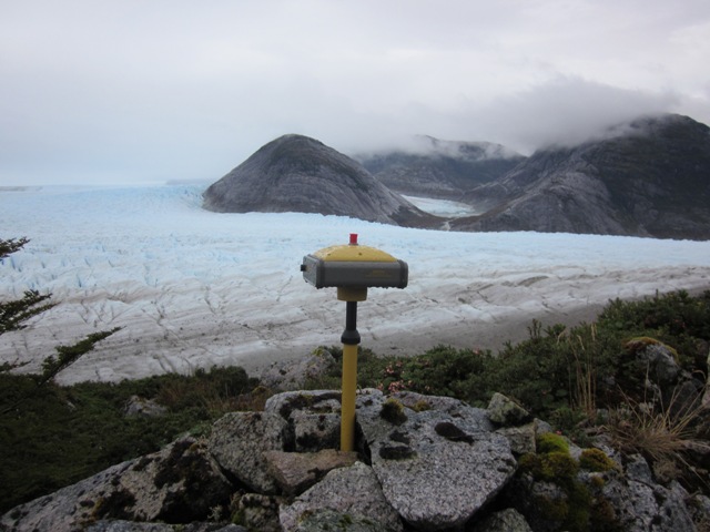
Wednesday 9th. Rain fell all the night. The front of the tent was blown in where the guys had come away from their anchors. Heavy showers continued through the day. We charged camera and survey equipment batteries and checked that they did work. Other minor tasks were also completed with the Sokkia set up for its base station task with external battery and solar panels.
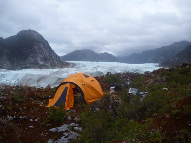 |
| The Oetzi Campsite |
Thursday 10th. First job of the day was to “start” the Sokkia GNSS (Global Navigation Satellite System) base receiver with three solar panels and a 7.2 Ampere hour battery connected to try to extend its operating time beyond eight hours of the internal battery. We used the ice bridge to gain access to Glacier Benito from Oetzi ridge. It took us some time to clear the difficult lake section of the glacier with Olaf scouting ahead periodically to find the best route and doing a couple of rope pitches over the more difficult sections. Then we were in the “flatter” area of the glacier where we measured the glacier altitude near the 2007 stakes position 5, 2, 3 and 4. Unfortunately we failed to record the position at stake 2. Getting off the glacier to go up the Punta Claus valley proved to be difficult with the last stage of traversing the lateral ridge requiring three pitches and some abseiling. Eventually we reached the unstable rocky slope at 19:45. We found a suitable campsite just as it was getting dark.
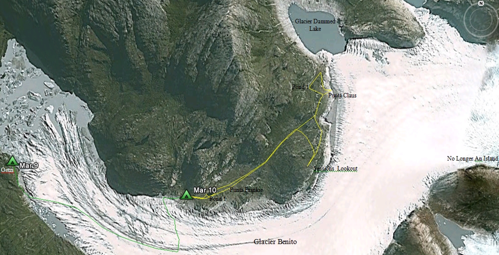 |
| Route across Glacier Benito and up “Punta Claus” valley* |
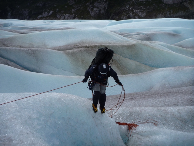 |
| Crossing Glacier Benito to “Punta Claus” valley |
Friday 11th. Today we explored the Punta Claus valley. When we reached the first pond we frightened six geese who then spent the next 30 minutes trying to land unsuccessfully on the steep, rocky valley side. Finding a large white granite rock that should be evident in Google Earth (Punta Frankie), we inserted a marker at the top of the rock and measured its position with the Hiperlite DNSS receiver. Next stop was Punta Claus itself that had been established but not surveyed properly in 2007. The Hiperlite was “run” at this point for two hours whilst we went off to mark a prominent pond (1) with the GMS-2 GPS logger and then on to look at a glacier dammed lake with many levels. During our walk, we found a site where the access to the glacier was easy for onward travel up the glacier, but we had run out of time to use this route, especially as the glacier was heavily crevassed in all directions when the south side was approached. Collecting the Hiperlite, we went to the ridge low point and as it was 17:00 decided to return to our tent site. The return trip took about 1 1/2 hours.
That evening we heard of the tragic news of the Japanese earthquake.
 |
| Measuring Punta Claus survey point with “No Longer an Island” in background |
Saturday 12th. Returning to the Punta Claus valley, we measured four points around a large pond (2) with the GMS-2 loggger. The Hiperlite would not record; we subsequently found that its memory was full. A better route was foound up the valley avoiding much of the thick bush and marshy ground that we had to force our way through the previous day. We wanted to go up another ridge and Peter had spotted a possible route up a steep valley. The going became tougher the higher we went due to the ever steepening slope and the thick vegetation filling the gulley. Finding an old tree stump, we measured its position; the question was whether it was older than the LIA. We moved on up the hill to the flat top (500 m above sea level) where we would have had an excellent view of the back of Glacier Benito if the cloud had lifted! A survey point was inserted into the rock and its position measured using the GMS-2; the position was named “Sessions Lookout”. Unfortunately the position was only measured for four minutes before the GMS-2 battery was flat. We dropped down to the low point in the ridge and returned to Punta Claus to repeat the panorama taken from that position. We returned to the tent at 18:30, finding a much better route back through the section of the valley that was heavily vegetated.
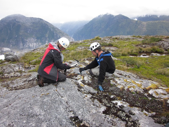 |
| Establishing a Survey Point at “Sessions Lookout” |
Sunday 13th. We left camp near the Punta Claus valley just after 10:00 with much lighter packs. A better route was used to transverse the lateral ridges/crevasses found at the side of the glacier so we were able to make rapid progress to the centre of the glacier then on to the position of the 2007 stake 2. We found the exit route off the glacier and crossed over the ice bridge again without any problem. Once off the glacier the rain started again. The packrafts were moved to their launching points, the Sokkia was retrieved together with a pressure measuring device, then we were off across the lake to the North Benito campsite. The route was blocked by ice in two places; at the first point the ice block was pulled aside but at the second site, we had to unload our boats, move them around the obstruction on the shore then load up again. The campsite was reached at 17:30; this time we could travel further away from the river mouth as a new passage had opened up in the floating and grounded ice. The evening news from the rear link was that the Chilean Navy pickup might be delayed as result of the earthquake/tidal waves. Also bad weather was due to return late on Tuesday 15th so we should hasten our return to Abra Kelly and cross it before the storm came.
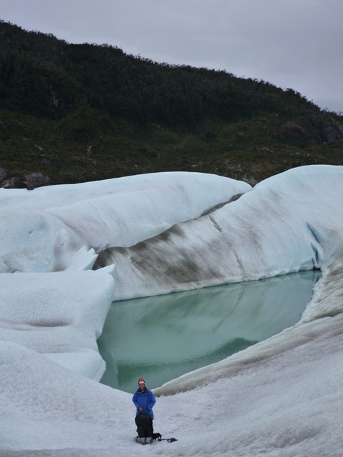 |
Several glacier bound ponds are discovered with the same level as Lago Proglacial Benito
indicating a possible further thinning of the glacier in this region |
Monday 14th. The Sokkia base station was installed at the 2007 Survey Station 1 whilst we did our first load carry through to Slimy Creek camp. This time we found even more of the 2007 route through the thick bush so the going was easier; we took two hours to reach the campsite. On return, Peter and Martin took three survey point measurements around two lakes using the hand held TopCon GMS-2 whilst Olaf set to work re-patching his boat as the original patch over a long cut had delaminated completely. We picked up the Sokkia base station, packed away the tent and went on our way to Slimy Creek, which we reached around 18:00. One thing that surprised Olaf and Martin was the compete lack of tadpoles in Slimy Creek. In 2007, there were many thousands of tadpoles and numerous frogs yet this time we saw very few frogs and no tadpoles at exactly the same time of year.
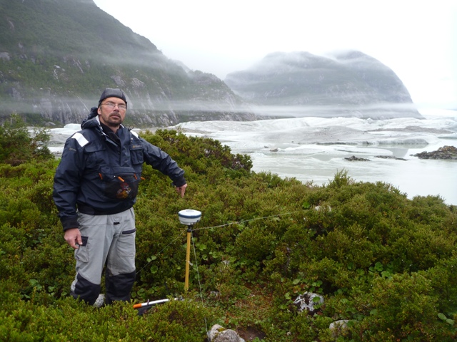 |
| Rechecking Station 1 established in 2007 with Sokkia GRX-1 GNSS Receiver |
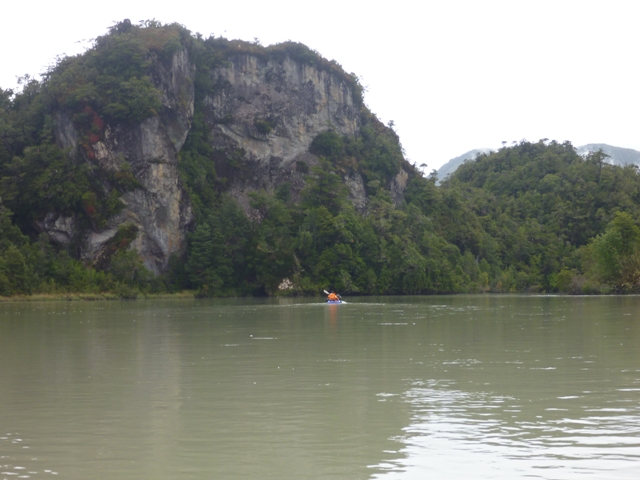
Tuesday 15th. At 10:30, wearing dry suits again, we set off down a tributary of Rio Andree for a short distance before joining the main stream, where we grounded as we had to go over a shallow bar. Initially we had to concentrate to avoid obstacles such as trees, tree stumps (‘strainers’), rocks and shallows whilst the river flow was fast, up to 6 km/hr. Once below the first river crossing the flow eased and we were able to relax more and take photographs. At 12:00, we reached the bar at Abra Kelly so stopped for a few minutes to re-inflate Olaf’s boat. So ended Martin’s third boat trip down Rio Andree (1973, 2007 and 2011) but Olaf also had done three trips down the river (2007 x 2 and 2011). Clearing the bar, as the tide was near its peak, we crossed Abra Kelly without incident with a following wind to aid our progress, reaching Punta Blanca at 13:30. Trolleys were retrieved from the bush and loaded up for the last time. Martin went to look for a 1972-1973 expedition survey point called ‘Astro’, and decided this time that he had found it as it fitted the description in the Hydrographic Report of that expedition; now a tree trunk covered in moss and bush in the middle of a sand ridge. After half an hours towing, the five day food dump was reached. The usual routine was followed as it was still sunny, namely unpack, dry out, charge batteries and repack with another five days of food to carry. The trolleys were taken apart with the wood placed in thick undergrowth where it could rot and the other components placed in the bags. At 20:00 the rain started again. Pressure dropped by 8 mbar and quite a storm was experienced that night.
 |
 |
| Paddling down Rio Andree past a prominent rock face |
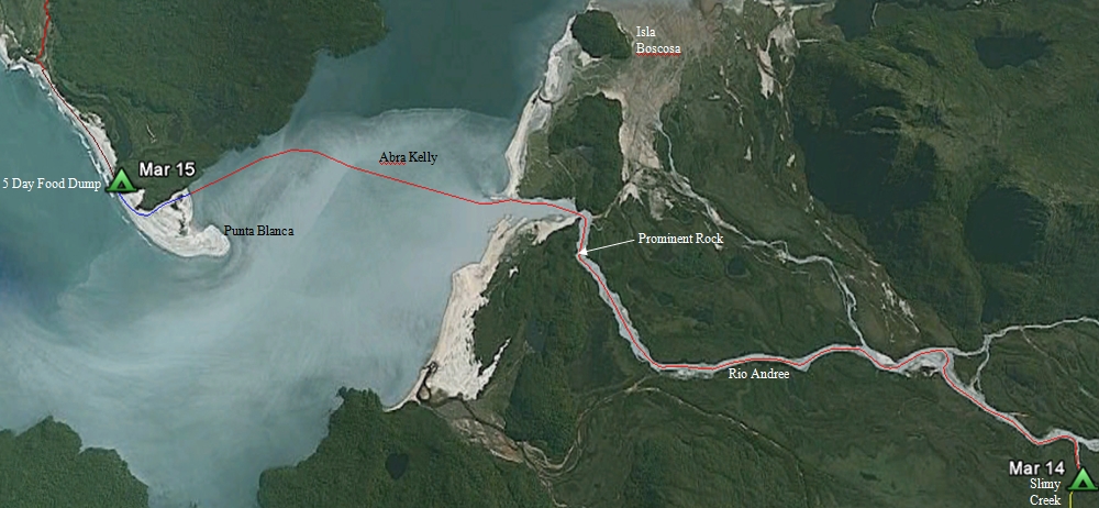
Route down Rio Andree and across Abra Kelly* |
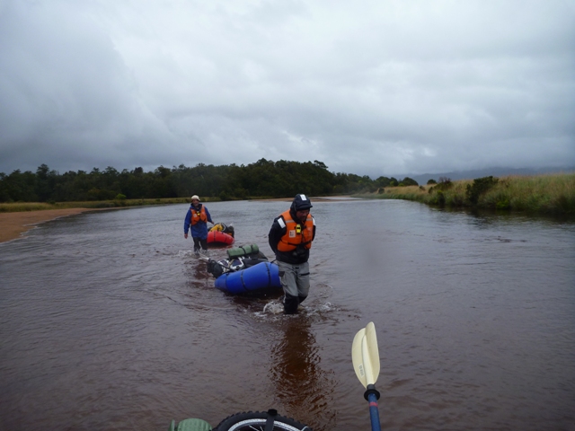
Wednesday 16th. Starting with a one km double load carry along the beach, we then tried to paddle up the river that leads towards Glacier San Quintin from Punta Cuchillo. However, a strong stream and a head wind meant that little progress was made so we resorted to towing our pack rafts. After 5.5 km we reached a 100 m cross-over point to another stream that would take us directly to a gap in a series of moraines that ring Lago San Quintin. The crossing was completed by 16:00 and we set off up the even smaller stream, albeit deep in places, occasionally above our belts and we were not wearing our dry suits. At 17:00 we decided to pitch camp, especially as the showers were increasing in frequency and intensity. The next day, we discovered that where we had chosen to camp was the last dry spot until the gap in the moraine; the terrain in between was very soggy marsh. The menu that night included cheese and biscuits, double soup, tuna, spaghetti with soya bean and topped off with marzipan!
 |
 |
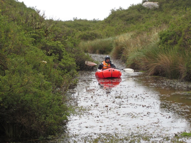
| Towing our packrafts up a shallow river on the way to Glacier San Quintin |
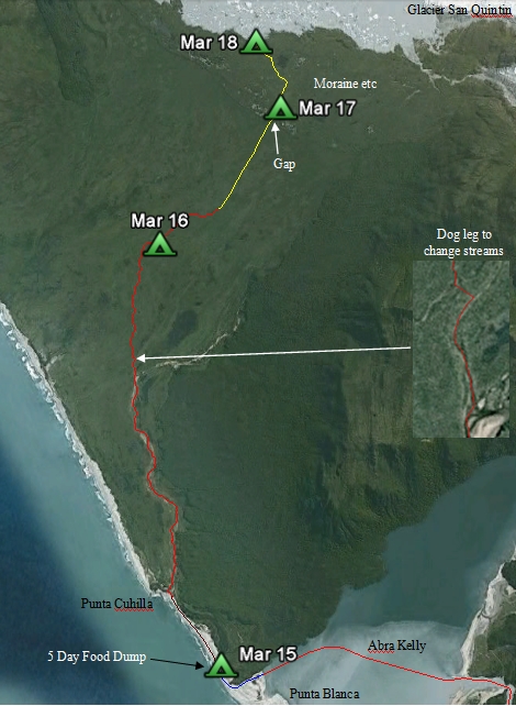
Route to Glacier San Quintin from Punta Cuhilla* |
Thursday 17th. Diary entry - What a Day! We stayed in bed for an extra 90 minutes, waiting for the rain to abate which it did. Setting off at 10:40, we towed our packrafts up the stream but it was chest deep in some places. Peter and Olaf had to return to the previous night’s campsite to retrieve a paddle that had been left behind but that did not delay us much. At 11:45, the stream was too small to tow through and blocked by thick reeds. So with 2.7 km to go to Glacier San Quintin, half the kit was dumped whilst we carried the other half through the marsh and swamp for 1 1/2 hours. This was strenuous work as everywhere you trod, your feet would disappear into water and ooze up to calf and sometime up to upper thigh. When we neared the gap in the moraine, the route was blocked by very thick, head high, moss covered bush but we located a stream that would enable us to bypass the bush. Returning for the second load was easier because the feet did not sink so far into the soaked vegetation but carrying the second heavy load changed that. In all it had taken us four hours to move all our kit 1.7 km. Olaf then boated all the kit, Martin and Peter past the thick bush, then went ahead to scout for a campsite which he found at 0.7 km point next to the stream. At 17:30, all the kit was at the campsite. Whilst Peter and Olaf set up tent and radio, Martin went on down to Lago San Quintin and established that the route to the glacier was pretty straight forward along several streams.
 |
Threading our way through the wide moraine at Glacier San Quintin.
The packraft allows us to avoid very thick moss covered bush |
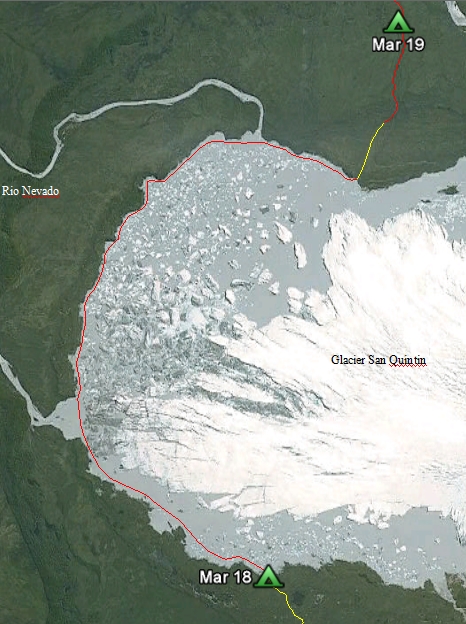
Friday 18th. Rain started at 06:00 and continued all day until 20:30. This was not a good day to boat around the glacier, the largest outlet glacier of Hielo Patagonico Norte (North Patagonian Icefield). At 10:00 we commenced our move to be closer to the glacial lake with the first load and, by 13:00, we pitched camp as the wind was adverse and would have made boating difficult. Peter’s flight to Australia would have to be changed as we were unlikely to reach Laguna San Rafael by 22nd. Due to a tragic accident in a fjord in the north of the region, the Navy could not pick us up until after 25th whilst CONAF could have given us a lift out on the 22nd when their support boat returns from the San Rafael park headquarters to Puerto Chucabuco.
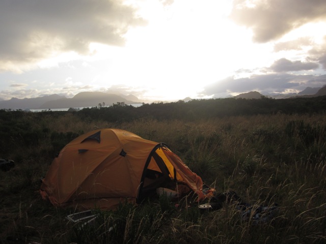 |
| Camping near Glacier San Quintin, waiting for fine weather and no wind to navigate 10 km lake |
Saturday 19th. The night was quite memorable because the rain stopped and when one individual went outside for a few minutes, he let in a whole squadron of mosquitoes. Then followed a very vicious attack on the insects inside the tent! When we emerged from the tent, the cloud was disappearing to the south east and bright weather came in from the north-west. At 09:45 we set off on a very memorable journey around the outside of Glacier San Quintin, making our way through floating ice of all shapes and sizes with big chunks of grounded glacier to our right. We stopped periodically to blow up Olaf’s still leaking boat. In calm weather, all we heard was the distant sound of the ocean and the crump as ice disintegrated somewhere!
 |
 |
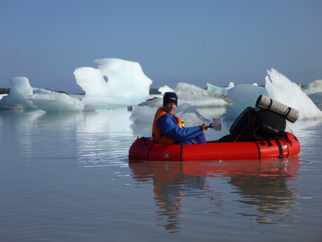
| A Day to Remember! Amongst the Ice of Glacier San Quintin |
Navigating Lago San Quintin* |
By 15:00, we had reached the journey’s end for the trip around the lake so we deflated boats and set off down another old outlet river on a double load carry. We reached a pool which we tried to walk alongside but our route was once again blocked by thick, head high, moss covered bush so we decided to use the packrafts again. Returning with the second load, and picking up our first load, we continued through a series of pools, thick with green algae, weeds and slime. The outlet from the pools was a small stream which we continued along until our way was blocked by reeds. Camp was set up on some very wet moss; it was very comfortable to sleep on. Martin did a quick recce and decided that the only route was in the stream.
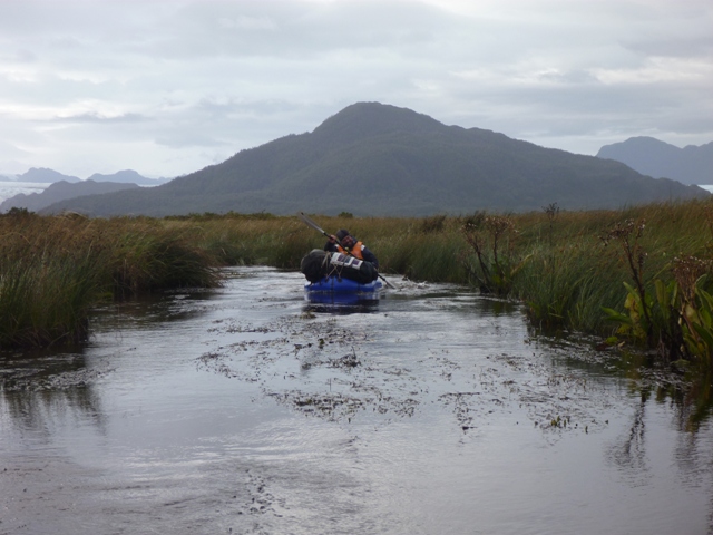
Sunday 20th. Epic day! Boating again on the other side of the reed bed, we had to shove our way through a couple of reed blockages but then the stream became faster and after 1 1/2 hours, we reached the white water of Rio Blanco. After getting our bearings, we went down the river pretty fast due to the current and had to concentrate hard to avoid the many tree stumps sticking up in the river. We overshot our planned landing point by 100 m so had to lift our kit up a steep river bank covered in thick vegetation.
 |
 |
| Enroute to Rio Blanco |
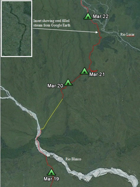
Route between Rio Blanco and Rio Lucar* |
The distance to our next destination as the crow flies, Rio Lucac, was about 6 km. After scouting for a good route, which we did not find, we did a 0.8 km double load carry through the marshland, followed by a one km double load carry. It was at the end of this second load carry that we stumbled across a reedy pool which we decided to follow using the boats again. Martin nearly trod on a very plump coypu who took off before he could be photographed. Coypu tracks were everywhere in the marshland. At 16:00, we embarked in the boats again, sometimes paddling and sometimes pulling them, getting wet up to our waists. The wind was getting stronger.
At 18:15 we decided to call halt as there was no dry camp site in sight so we would have to take other measures for the night. We went for a scout for dry land; Peter and Martin were not so enthusiastic as Olaf as they were wet through to their skin. Olaf decided he had found a marginally drier spot so we cut reads with our penknives for 15 minutes and used the reeds for the tent base. Then we moved our important gear the 200 m across the marsh to the camp site, blew up the boats to act as the base of the tent, tied the boats together. However the strong wind meant that pitching the tent on the upturned boats was going to be difficult. It was getting dark. So two inflated boats were put inside the tent and weighted down with kit to stop the tent blowing away. Rucksacks were placed on rafts made from the trolley wheels. The tent was tied to rucksacks and some dead wood salvaged from nearby, then erected quickly. Finally the flysheet was placed in position and the whole lot anchored as best as could be achieved in the dark. The tent porch was a pool of water so there was no cooking that night; the meal consisted of biscuits, cheese, tuna and a fortified cold Milo drink! Peter “slept” in one boat, Martin in the other and Olaf somehow perched between the two boats. The wind became stronger and stronger, then there was a short period of intense rain followed by total calm!
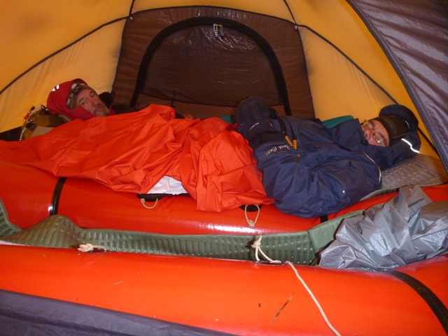 |
“Crisis” in the Swamp;
no dry land to camp on and a storm made pitching camp difficult so we slept in two packrafts |
Monday 21st. The tent was packed up with us standing up to our calves in water. The whole area around the tent was turned into a lake by the time we had finished. Back at the stream, we battled our way through the reeds, sometimes pulling the boats up to waist deep in water and sometimes paddling furiously to try and get through the vegetation. We tried to follow the stream, but where this widened out, the reeds became thicker and the stream harder to follow. After two hours, we came across a small dry area, and, as we had missed our transport and Olaf’s boat needed repatching, decided to call a halt for the day. Also Martin and Peter were pretty wet, having not worn their dry suits the previous day. A hot main meal at midday would not go amiss after not having the usual porridge for breakfast. Olaf, with good advice from Jammie using Google Earth, worked out that we needed to shift streams, a distance of 150 m across the marshland. Boat repair commenced and to limit the patch delaminating, Australian Geographic stickers were used to protect the edges of the patch.
Tuesday 22nd. When the alarm clock went off it was usually dark between 06:30 and 07:00. This morning we had eaten breakfast and were thinking about getting up when Olaf checked the time on his watch to discover that it was 05:45. Martin’s alarm clock had accidentally gone off two hours early! After going back to sleep for an hour, we packed up the tent and did the double load lift to the second stream. We towed through the reeds until we came to a decision point. To the right was a series of pools that looked promising and to the left was the smallest of streams. We tried the pools which were stagnant and as we disturbed the mud, smelt hydrogen sulphide; no, it wasn’t Volcan Hudson erupting. After travelling through the pools for 20 minutes or so, we came to a dead end in the direction we wanted to go so we returned to where we had branched right and tried to follow the stream which was very difficult to identify. Today, Peter and Martin wore their dry suits so could go deeper in the water when towing. Taking turns at the front, we alternatively towed and paddled depending on the thickness of the reeds, stopping periodically to stand up above the reeds to see the way ahead. On a couple of occasions we climbed up tree stumps. We passed through Jammie’s GPS points in quite quick succession and found ourselves in quite a narrow reedy stream. Finally at 15:45 we stopped for a good look around as the reeds were getting thicker again. Olaf and Peter went towards the north-east but Martin continued along the edge of the stream. After 50 m, Martin saw a tributary of Rio Lucar so called the others back to the boats. We pulled our way through the final set of reeds then joined the stronger stream. After a short distance, we were in the main river. After floating down the main river for a couple of hundred metres, a suitable bank was found for a campsite so a halt was called for the day as Olaf was wet through. In fact it was a wise decision as going down the River Lucar would require much concentration due to the thousands of tree stumps and other obstacles that could easily puncture the single cell boats. The peaks of the hills to the east were covered with fresh snow.
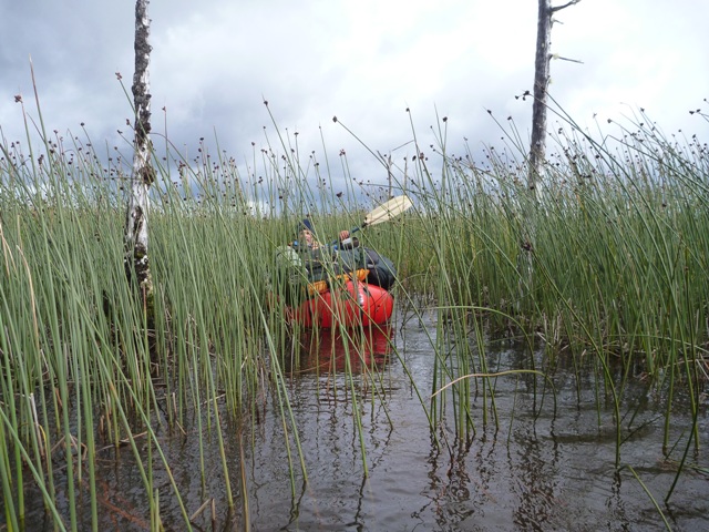 |
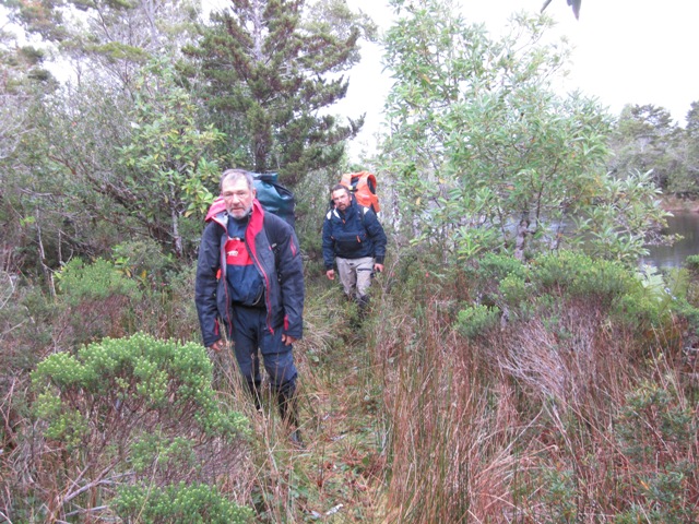
| Battling the reeds of the swamp between Rio Blanco and Rio Lucar |
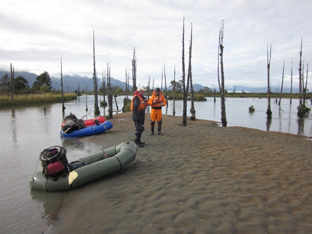
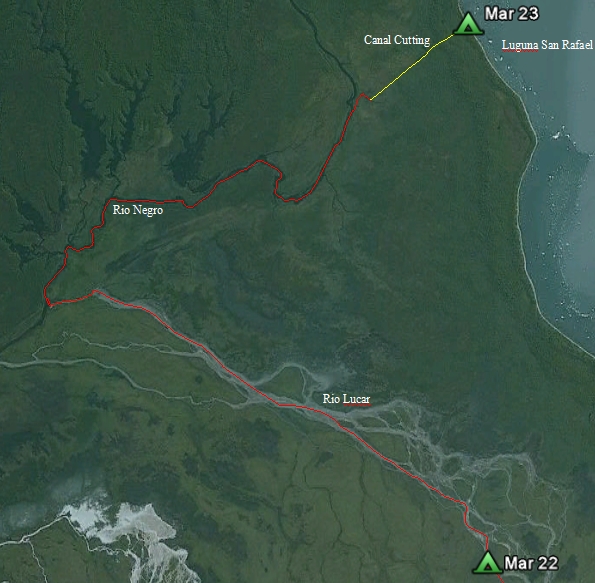
Wednesday 23rd. At 09:50 we embarked in our packrafts for the last time in this expedition for the trip down Rio Lucac and up Rio Negro. Good navigation was required because of the many streams that Rio Lucar splits into in the delta region. Soon we were travelling down river at six km/hr. For most of the way, the river was crowded with tree stumps of an old forest and we had to concentrate to prevent our single cell boats from getting punctured. Some of the stumps were pointing upstream so we had to be very careful in avoiding them, whilst the tops of others were just under the surface and occasionally we had unexpected bumps as we went over the top of them. The sight of the maze of stumps was amazing. Despite stopping a couple of times to inflate Olaf’s boat and check our course, progress was rapid, and at 11:30 we went down the critical northern most branch that would take us to Rio Negro. The stream became deeper and the strainers fizzled out; at 12:02 we reached the black water of Rio Negro.
 |
 |
Checking progress on Rio Lucar – must not miss the right turn.
River was full of dead trees which made paddling challenging
as we tried to avoid damage to our single cell boats! |
Route Rio Lucar to Laguna San Rafael* |
After stopping for 20 minutes to transmit a Spot position, we paddled steadily up the Rio Negro for three hours reaching the small side stream, marked by a food bag slung between two trees, that took us towards the canal cutting without incident. The food bag was raided for our lunch packs as we had run out of lunches! Kit was moved to a position slightly above the swampy ground. Boats were deflated for the last time (they had been inflated about 15 times altogether on the trip and had covered about 85 km). Carrying our rucksacks, we reached Laguna San Rafael beach at 17:00. After a short debate, we decided to get the remaining kit the next day. Olaf contacted the Park Rangers who said that the weather was going to be windy and wet the next day and not suitable for a pick up. We found the semi-permanent campsite this time.
Thursday 24th. At 09:00, we departed in wind and rain to collect the other three bags from near Rio Negro. The walk to the drop site was easy now, taking just 35 minutes, so we picked up our loads for the last time and returned to the campsite by 11:00. At 17:00, the storm died down so we went for a walk along the beach, collecting rubbish, mostly plastic and rope. Part of the day was spent discussing options for pick up, which had reduced as it was the end of the season and fewer boats came to the laguna to view Glacier San Rafael carving at sea level.
 |
| The Final Load |
Friday 25th. 08:00. The Park Rangers said that they would pick us up at 09:20 so we raced around packing up our kit and tent. The laguna was calm when Fransciso and Mario arrived. As we crossed the laguna to the Park Headquarters, the wind picked up. We were treated to Matte tea in the HQ building before we were taken to the campsite. Following discussions with the Rangers, Olaf suggested we could undertake some survey work so the Sokkia base station was set up on the airstrip whilst Peter and Martin walked to lookup for Glacier San Rafael and proceeded to measure and mark a couple of points along the 90 minute track. Whilst at the lookout, hundreds of geese were observed flying into their roosting site on a cliff face near the ice front. About six large blocks of ice fell off the glacier whilst they were recording the position, providing entertainment.
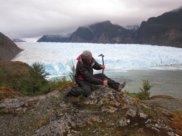 |
| Inserting a Survey Point at the Glacier San Rafael Lookout |
Saturday 26th. A day of confusion ending up with a wonderful outcome! We returned to the Park HQ with all our kit at 09:30, expecting to be taken around to the main jetty from the HQ jetty to await embarkation in Patagonian Express later in the afternoon. In the meantime we measured some more points with the GMS-2 GPS recorder. Whilst we were waiting, a helicopter flew over; it was not expected until the Sunday. Negotiations between the Park Rangers, the pilot and the charterer of the helicopter indicated that we could be taken back to the helicopter base at 12:00. Subsequently when we met the pilot, he indicated that two of us could go with six smaller bags whilst Olaf would continue with the latest plan of travelling back to Coyhaique in the Patagonian Express, which was on a special charter, with the three barrels and his rucksack. Later Peter and Martin were flown to Puerto Aysen airfield by helicopter along the fjords and were dropped off at the closed Air Terminal. Without money or phone, they were not sure how to alert Jammie where they were, but Spot came to the rescue. Jammie picked them up at 18:00 and returned them to her house at the 21 km road marker. Later at midnight, Olaf was collected from Puerto Chucabuco, remarking that he had eaten two dinners on the Patagonian Express and had entertained about 50 of the passengers with his stories of the expedition. So ended our amazing journey at 02:30 on Sunday.
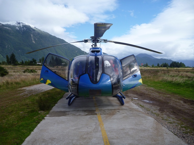 |
| Our Final Method of Transport – At Puerto Aysen |
Sunday 27th to Thursday 31st. Unpacking kit, initial data analysis, returning loaned equipment, celebrating etc
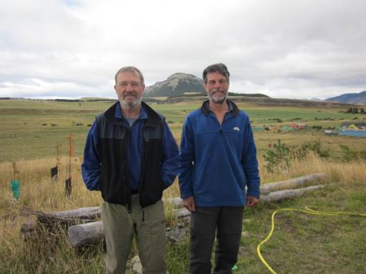 |
| The After Photo - 7 kgs lighter! |


