
| Home | Puerto Montt to Kelly Inlet | Gl. San Quintin | Kelly Inlet to Gl. Andree | Kelly Inlet Camp etc | Kelly Inlet Scenery | Kelly Inlet to Puerto Montt | Contact |
11-October-2021
|
|
|
|
|
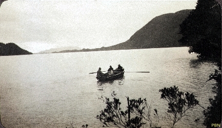
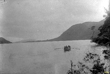
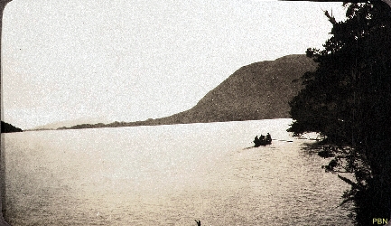
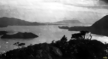
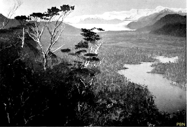
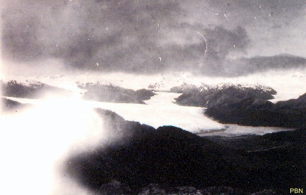
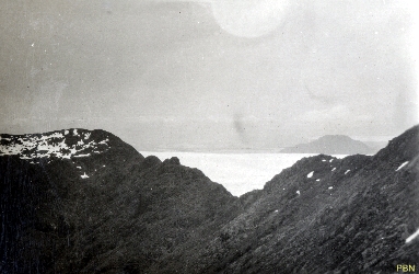
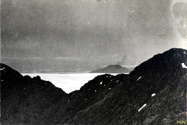
| Setting off for 'Darwin's falls' on the North shore of Kelly Inlet on Chistmas Eve 1920 (0220) | Going to 'Darwin's falls" on the North shore of Kelly Inlet on Chistmas Eve 1920 (0221) | Going to 'Darwin's falls" on the North shore of Kelly Inlet on Chistmas Eve 1920 (0222) | Kelly Inlet - Darwin Falls near Base Camp - the site of the first attempt to cross the range (0253) | Kelly Inlet photographed from the route to Glacier San Tadeo. Xavier Island in the distance (0050) |
|
|
|
|
|
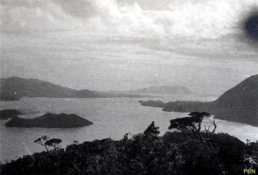
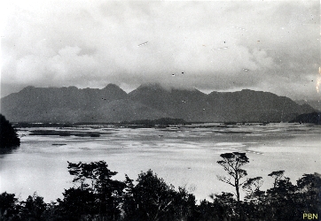
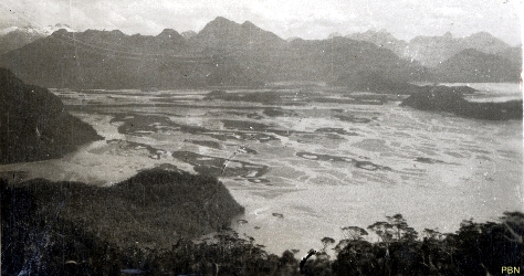
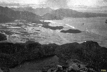
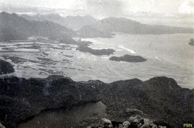
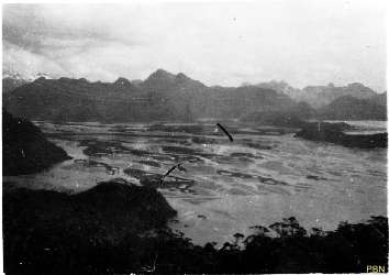
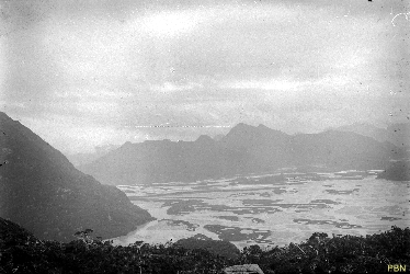
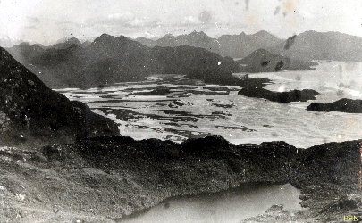
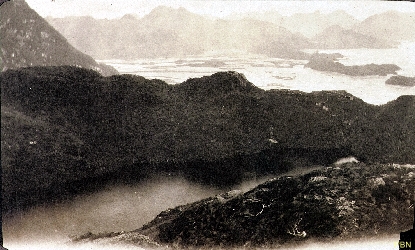
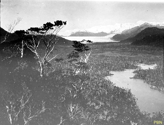
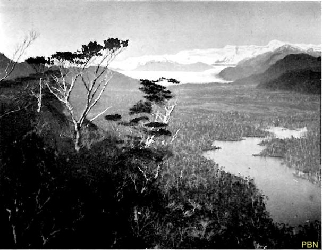
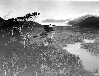
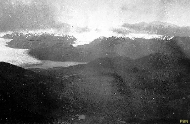
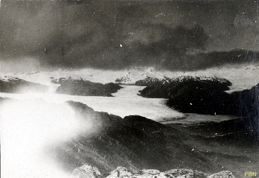
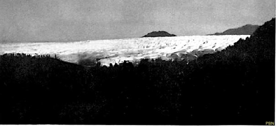
| Kelly Inlet photographed from the route to Glacier San Tadeo. Xavier Island in the distance. Isla Boscosa is the largest island in the foreground. (0051) | Mud flats in Kelly Inlet from the Route to Glacier San Tadeo (0049) | Mud flats in Kelly Inlet from the AndreÚ River and the Benito Glacier (0053) | Mud flats in Kelly Inlet from the AndreÚ River and the Benito Glacier (0052) | Mud flats in Kelly Inlet from the AndreÚ River and the Benito Glacier (0055) |
|
|
|
|
|
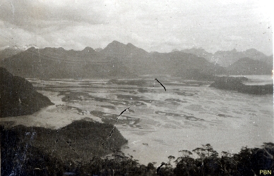
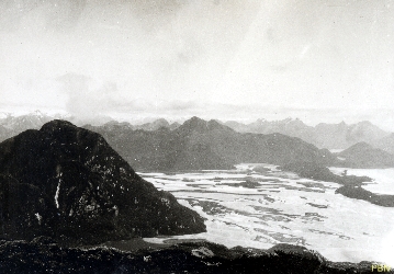
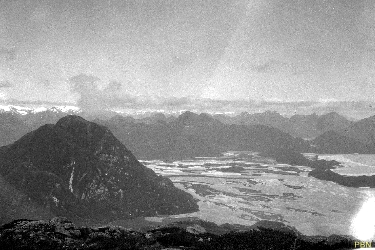
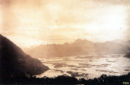
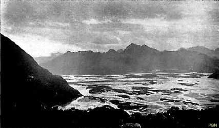
| Mud flats in Kelly Inlet from the AndreÚ River and the Benito Glacier. Co Pylorus is the large hill on the left. (0054) | Mud flats in Kelly Inlet from the AndreÚ River and the Benito Glacier (0056) | Mud flats in Kelly Inlet from the AndreÚ River and the Benito Glacier (0057) | Mud flats in Kelly Inlet from the AndreÚ River and the Benito Glacier (New) (0278) | Mud flats in Kelly Inlet from the AndreÚ River and the Benito Glacier (0058) |
|
|
|
|
|
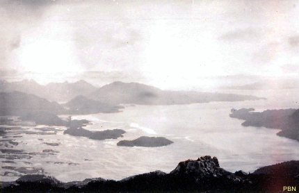
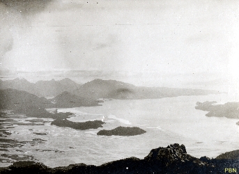
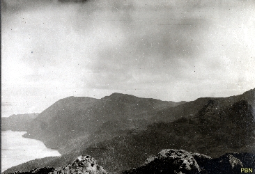
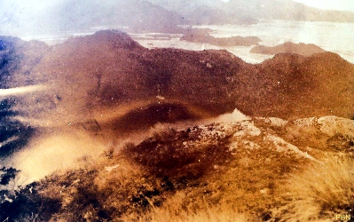
| Mud flats in Kelly Inlet from the AndreÚ River and the Benito Glacier (New) (0279) | Mud flats in Kelly Inlet from the AndreÚ River and the Benito Glacier (0061) | Mud flats in Kelly Inlet from the AndreÚ River and the Benito Glacier (0059) | Mud flats in Kelly Inlet from the AndreÚ River and the Benito Glacier (0060) | Looking West en route to Glacier San Tadeo, viewing the North shore of Kelly Inlet (0062) |
|
|
|
|
|
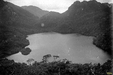
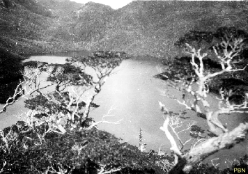
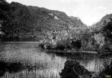
| Mud flats in Kelly Inlet from the AndreÚ River and the Benito Glacier with Lago Steffen in the foreground (0063) | Lago Steffen with the mud flats in the background (0064) | Lago Steffen with the mud flats in the background (0065) | Lago Steffen looking East (0067) | Lago Steffen looking East (0071) |
|
|
|
|
|
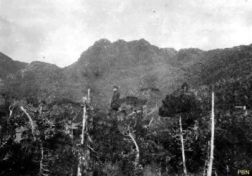
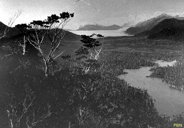
| Lago Steffen looking East (0069) | Geese on a small pond (0066) | En route to Glacier San Tadeo - the Professor (0068) | En route to Glacier San Tadeo - looking towards the Kelly Glacier (Glacier AndreÚ) (0070) | En route to Glacier San Tadeo - looking towards the Kelly Glacier (Glacier AndreÚ) (0075) |
|
|
|
|
|
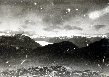
| En route to Glacier San Tadeo - looking towards the Kelly Glacier (Glacier AndreÚ) (0072) | En route to Glacier San Tadeo - looking towards the Kelly Glacier (Glacier AndreÚ) (0073) | En route to Glacier San Tadeo - looking towards the Kelly Glacier (Glacier AndreÚ) (0074) | En route to Glacier San Tadeo - nearing the 'Bowler' (0077) | En route to Glacier San Tadeo - nearing the 'Bowler' (0076) |
|
|
|
|
|
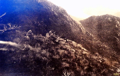
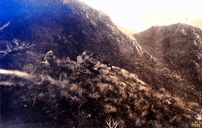
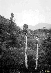
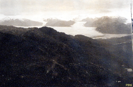
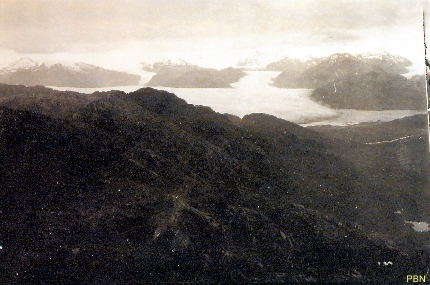
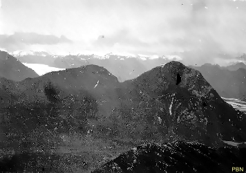
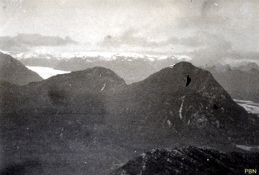
| Some of the vegetation en route (0078) | Looking towards the North-East - Kelly Glacier whilst ascending the Bowler (0079) | Looking towards the North-East - Kelly Glacier whilst ascending the Bowler (New) (0281) | Looking towards the North-East - Kelly Glacier whilst ascending the Bowler (New) (0280) | Looking towards the North-East - Kelly Glacier whilst ascending the Bowler (New) (0282) |
|
|
|
|
|
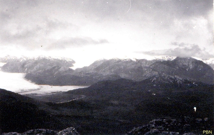
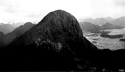
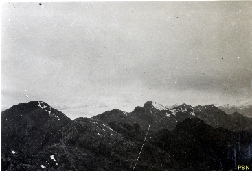
| Summit of the Knalhatten (Bowler Hat) taken from Stortoppen (Big Top - 760 m). Knalhatten was also known as Cerro Pan (0080) | Looking towards the Benito Glacier on left and Pyloros on right. The mud flats just evident on right. (0085) | Looking towards the Benito Glacier on left and Pyloros on right. The mud flats just evident on right. (0086) | Looking towards the South East and South (Benito) Glacier. The snow line on the range is about 500 m above sea level. (0081) | More of Kelly Glacier is revealed as well as Rabot Glacier flowing from the South Glacier (0087) |
|
|
|
|
|
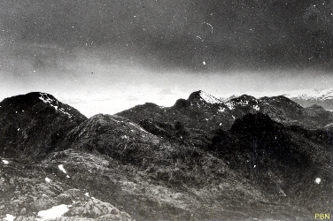
| Looking towards the East - Kelly Glacier with, in the centre, Glacier Rabot (0088) | Looking towards the East - Kelly Glacier with, in the centre, Glacier Rabot (0089) | Looking towards the North-East û Kelly Glacier with left to right Glaciers Strinberg, Fraenkel and Rabot (0091) | Looking towards the North-East û Kelly Glacier with left to right Glaciers Strinberg, Fraenkel and Rabot (0090) | Looking towards the North-East û Kelly Glacier with left to right Glaciers Strinberg, Fraenkel and Rabot (New) (0283) |
|
|
|
|
|
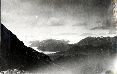
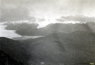
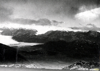
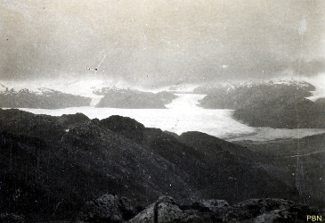
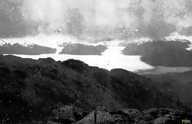
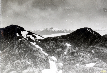
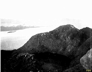
| Looking towards the North-East û Kelly Glacier with left to right Glaciers Strinberg, Fraenkel and Rabot (0092) | View of Glacier San Quintin from the Big Top looking North East. (0084) | View of Glacier San Quintin from the Big Top looking North East. When the picture is enhanced, Mt San Valentin, the highest mountain on the icefield, can be observed. (0083) | View of Glacier San Quintin from the Big Top looking North East (0082) | Tadeo Glacier with Rock Tarn in Foreground. Note the emerging rock from the glacier. (0097) |
|
|
|
|
|
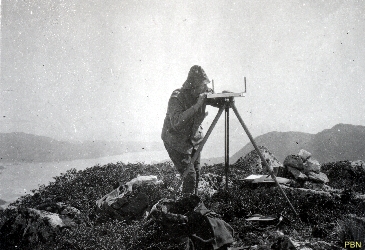
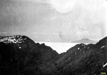
| Surveying from the Stortoppen (Big Top) using a Plane Table (0093) | Looking towards the North to Mt Yanez and Laguna San Rafael in the far distance behind Mt Yanez (0094) | Looking towards the North to Mt Yanez and Laguna San Rafael in the far distance behind Mt Yanez (0095) | Looking towards the North to Mt Yanez and Laguna San Rafael in the far distance behind Mt Yanez (0096) | Tadeo Glacier from the South looking East (0098) |
|
|
|||
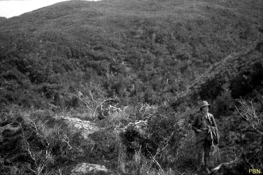
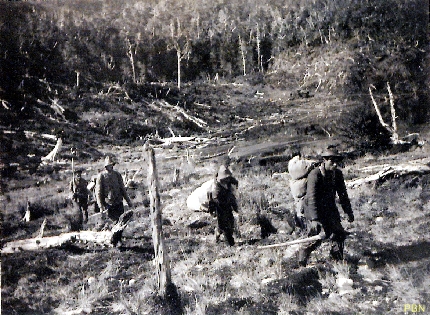
| Travelling in the bush between Kelly Inlet and Glacier San Tadeo (0099) | Approaching Warm Tarn. In the foreground are the two Chilotes followed by Allan and Nils (New) (0286) | |||